East Seram Regency
| East Seram Regency Kabupaten Seram Bagian Timur | ||
|---|---|---|
| Regency | ||
| ||
 Location within Maluku | ||
| Coordinates: 3°23′55″S 130°23′30″E / 3.3985°S 130.3917°ECoordinates: 3°23′55″S 130°23′30″E / 3.3985°S 130.3917°E | ||
| Country |
| |
| Province |
| |
| Capital | Bula | |
| Government | ||
| • Regent | Mukti Keliobas | |
| • Vice Regent | Fachri H. Alkatiri | |
| Area | ||
| • Total | 6,429.88 km2 (2,482.59 sq mi) | |
| Population (2014) | ||
| • Total | 110,350 | |
| • Density | 17/km2 (44/sq mi) | |
| Time zone | UTC+9 (IEST) | |
| Area code | (+62) 911 | |
| Website |
serambagiantimurkab | |

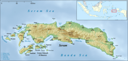
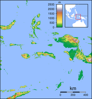

East Seram Regency (Indonesian: Kabupaten Seram Bagian Timur) is a regency of Maluku, Indonesia. It is mainly located on the island of Seram, but also includes smaller islands to the southeast such as Gorom and Wakate. The Regency covers a land area of 6,429.88 sq,km, and had a population of 99,065 at the 2010 Census[1]; the latest official estimate (as at January 2014) was 110,350. The principal town lies at Bula.
Administration
At the time of the 2010 Census the regency was divided into six districts (kecamatan), tabulated below with their 2010 Census population.
| Name | Area in sq.km | Population Census 2010 |
|---|---|---|
| Bula | 2,248.6 | 24,037 |
| Seram Timur (East Seram) | 1,136.7 | 24,018 |
| Tutuk Tolu | 435.2 | 4,722 |
| Werinama | 1,823.8 | 9,752 |
| Pulau Gorom (Gorom Island) | 152.0 | 27,285 |
| Wakate | 66.4 | 9,251 |
The first four of these six districts were on the island of Seram; Wakate and (Pulau) Gorom are groups of smaller islands situated to the southeast of Seram.
Subsequent to 2010, ten additional districts have been created by the division of the original six districts, so that the regency is now divided into sixteen districts (kecamatan). The ten new districts are:
- Siwalalat
- Teor - from part of Wakate
- Pulau Panjang (Panjang Island) - from part of Pulau Gorom
- Bula Barat (West Bula)
- Kilmury
- Gorom Timur (East Gorom) - from part of Pulau Gorom
- Teluk Waru (Waru Bay)
- Siritaun Wida Timur (East Siritaun Wida)
- Kian Darat
- Ukar Sengan
References
- ↑ Biro Pusat Statistik, Jakarta, 2011.