Buru Regency
| Buru Regency Kabupaten Buru | ||
|---|---|---|
| Regency | ||
| ||
|
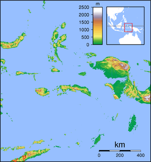
Location within Maluku | ||
| Coordinates: 3°19′40″S 126°41′03″E / 3.3277°S 126.6841°ECoordinates: 3°19′40″S 126°41′03″E / 3.3277°S 126.6841°E | ||
| Country |
| |
| Province |
| |
| Capital | Namlea | |
| Government | ||
| • Regent | Ramly I. Umasugi | |
| • Vice Regent | Amustofa Besan | |
| Area | ||
| • Total | 4,932.32 km2 (1,904.38 sq mi) | |
| Population (2014) | ||
| • Total | 120,798 | |
| • Density | 24/km2 (63/sq mi) | |
| Time zone | UTC+9 (IEST) | |
| Area code | (+62) 913 | |
| Website |
burukab | |
Buru Regency is a regency of Maluku, Indonesia. It is located on the island of Buru. The Regency comprises the northern half of Buru and covers an area of 4,932.32 sq.km. The population at the 2010 Census was 108,445;[1] the latest official estimate (as at January 2014) was 120,798. The principal town lies at Namlea.
Administration
The regency is divided into five districts (kecamatan), tabulated below with their 2010 Census population.
| Name | Area in sq.km | Population Census 2010 |
|---|---|---|
| Namlea | 312.0 | 37,218 |
| Waeapo | 1,373.8 | 34,153 |
| Waplau | 551.6 | 10,000 |
| Bata Bual | 430.0 | 8,147 |
| Air Buaya | 1,792.3 | 18,927 |
References
- ↑ Biro Pusat Statistik, Jakarta, 2011.
This article is issued from
Wikipedia.
The text is licensed under Creative Commons - Attribution - Sharealike.
Additional terms may apply for the media files.


