East Lansdowne, Pennsylvania
| Borough of East Lansdowne | |
|---|---|
| Borough | |
_Fire_Dept.JPG) Fire Department | |
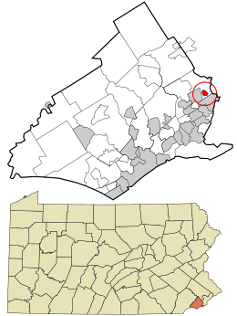 Location in Delaware County and the U.S. state of Pennsylvania. | |
 East Lansdowne Location of East Lansdowne in Pennsylvania  East Lansdowne East Lansdowne (the US) | |
| Coordinates: 39°56′39″N 75°15′37″W / 39.94417°N 75.26028°WCoordinates: 39°56′39″N 75°15′37″W / 39.94417°N 75.26028°W | |
| Country | United States |
| State | Pennsylvania |
| County | Delaware |
| Area[1] | |
| • Total | 0.21 sq mi (0.53 km2) |
| • Land | 0.21 sq mi (0.53 km2) |
| • Water | 0.00 sq mi (0.00 km2) |
| Elevation | 118 ft (36 m) |
| Population (2010) | |
| • Total | 2,668 |
| • Estimate (2016)[2] | 2,656 |
| • Density | 12,893.20/sq mi (4,970.22/km2) |
| Time zone | UTC-5 (EST) |
| • Summer (DST) | UTC-4 (EDT) |
| ZIP code | 19050 |
| Area code(s) | 610 and 484 |
| FIPS code | 42-21384 |
| Website |
www |
East Lansdowne is a borough in Delaware County, Pennsylvania, United States. The population was 2,668 at the 2010 census.
Geography
East Lansdowne is located at 39°56′39″N 75°15′37″W / 39.94417°N 75.26028°W (39.944162, -75.260253).[3]
According to the United States Census Bureau, the borough has a total area of 0.2 square miles (0.52 km2), all of it land.
East Lansdowne is located about a half a mile west of Southwest Philadelphia and is surrounded by Upper Darby Township, namely the Stonehurst/Stonehurst Hills/69th Street and Fernwood neighborhoods. Union Avenue to the west separates Lansdowne from Upper Darby, while the East Lansdowne border is near Hirst Avenue, leaving a one-block expanse of land that is part of Upper Darby Township. It is the former railroad track that gives East Lansdowne borough's western boundary that vaguely ovoid shape.
The borough of Yeadon is south of the SEPTA Media/Elwyn Line Railroad tracks, about one block south of East Lansdowne.
Demographics
As of Census 2010, the racial makeup of the borough was 30.5% White, 55.8% African American, 0.1% Native American, 8.8% Asian, 0.2% Native Hawaiian and Other Pacific Islander, 1.3% from other races, and 3.1% from two or more races. Hispanic or Latino of any race were 4.3% of the population. 22.1% of the borough's population was foreign-born .
As of Census 2000, the population density was 12,517.6 people per square mile (4,754.6/km²). There were 1,012 housing units at an average density of 4,898.6 per square mile (1,860.6/km²). The racial makeup of the borough was 71.2% White, 26.8% African American, 0.08% Native American, 6.03% Asian, 0.46% from other races, and 1.70% from two or more races. Hispanic or Latino of any race were 1.24% of the population.
There were 938 households, out of which 32.8% had children under the age of 18 living with them, 45.6% were married couples living together, 12.7% had a female householder with no husband present, and 35.1% were non-families. 28.9% of all households were made up of individuals, and 10.3% had someone living alone who was 65 years of age or older. The average household size was 2.71 and the average family size was 3.41.
In the borough the population was spread out, with 25.8% under the age of 18, 8.6% from 18 to 24, 31.7% from 25 to 44, 19.9% from 45 to 64, and 14.0% who were 65 years of age or older. The median age was 37 years. For every 100 females there were 100.2 males. For every 100 females age 18 and over, there were 93.6 males.
The median income for a household in the borough was $44,205, and the median income for a family was $53,021. Males had a median income of $37,813 versus $28,409 for females. The per capita income for the borough was $19,558. About 6.2% of families and 7.6% of the population were below the poverty line, including 4.9% of those under age 18 and 10.0% of those age 65 or over.
Notable features
Oldest 4th of July parade and celebration in Delaware County, PA.
Education
William Penn School District serves East Lansdowne.
- East Lansdowne Basics Magnet Elementary School (K-6)
- Penn Wood Middle School (7-8) (Darby)
- Penn Wood High School, Cypress Street Campus (9-10)(Yeadon)
- Penn Wood High School, Green Ave Campus (11-12) (Lansdowne)
Private schools:
- Saint Cyril of Alexandria Catholic Elementary School (K-8)
References
- ↑ "2016 U.S. Gazetteer Files". United States Census Bureau. Retrieved Aug 13, 2017.
- 1 2 "Population and Housing Unit Estimates". Retrieved June 9, 2017.
- ↑ "US Gazetteer files: 2010, 2000, and 1990". United States Census Bureau. 2011-02-12. Retrieved 2011-04-23.
- ↑ http://www.dvrpc.org/data/databull/rdb/db82/appedixa.xls
External links
Municipalities and communities of Delaware County, Pennsylvania, United States | ||
|---|---|---|
| City | 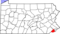 | |
| Boroughs | ||
| Townships | ||
| CDPs | ||
| Unincorporated communities |
| |
| Ghost town | ||
| Footnotes | ‡This populated place also has portions in an adjacent county or counties | |