Crum Lynne, Pennsylvania
| Crum Lynne, Pennsylvania | |
|---|---|
| Unincorporated community | |
 Crum Lynne Location of Crum Lynne, Pennsylvania  Crum Lynne Crum Lynne (the US) | |
| Coordinates: 39°52′20″N 75°19′41″W / 39.87222°N 75.32806°W | |
| Country | United States |
| State | Pennsylvania |
| County | Delaware |
| Township | Ridley |
| Elevation[1] | 62 ft (19 m) |
| Time zone | UTC-5 (Eastern (EST)) |
| • Summer (DST) | UTC-4 (EDT) |
| ZIP code | 19022 |
| Area code(s) | 610 and 484 |
| FIPS code | 42-42045 |
| GNIS feature ID | 1203375[1] |
| Other names |
Leiperville Crumlynne |
| [2] | |
Crum Lynne is an unincorporated community in Ridley Township, Delaware County, Pennsylvania, United States.
Geography
Crum Lynne is located at 39°52′20″N 75°19′41″W / 39.87222°N 75.32806°W (39.872335, -75.327966).[1] Its elevation is 62 feet (19 m) and its hardiness zones are 7a and 7b.
Transportation
A station on the former Pennsylvania Railroad Philadelphia - Baltimore line, now the Crum Lynne SEPTA regional rail station, was named by a Pennsylvania Railroad vice president after Crumlin, Wales, where his mother was born.
The town also houses the headquarters of the Federal Railroad Administration's Office of Safety for Region 2, which governs Delaware, Maryland, New Jersey (from Camden south), Pennsylvania, Ohio, Virginia, West Virginia, and the District of Columbia.
Interstates 95 and 476 have an interchange in Crum Lynne. They form the southern and western boundaries, respectively. MacDade Boulevard is Crum Lynne's main east-to-west thoroughfare and parallels 95.
References
- 1 2 3 U.S. Geological Survey Geographic Names Information System: Crum Lynne, Pennsylvania. Retrieved on 2008-08-27.
- ↑ "ZIP Code Lookup". Archived from the original on 2011-06-15. Retrieved 2008-08-27.
External links
- Crumlynne at Ridley Township History
Municipalities and communities of Delaware County, Pennsylvania, United States | ||
|---|---|---|
| City | 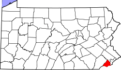 | |
| Boroughs | ||
| Townships | ||
| CDPs | ||
| Unincorporated communities |
| |
| Ghost town | ||
| Footnotes | ‡This populated place also has portions in an adjacent county or counties | |
Coordinates: 39°52′20″N 75°19′41″W / 39.872335°N 75.327966°W