East Fork Township, Clinton County, Illinois
| East Fork Township | |
|---|---|
| Township | |
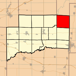 Location in Clinton County | |
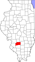 Clinton County's location in Illinois | |
| Coordinates: 38°41′57″N 89°11′49″W / 38.69917°N 89.19694°WCoordinates: 38°41′57″N 89°11′49″W / 38.69917°N 89.19694°W | |
| Country | United States |
| State | Illinois |
| County | Clinton |
| Established | November 4, 1873 |
| Area | |
| • Total | 37.62 sq mi (97.4 km2) |
| • Land | 31.58 sq mi (81.8 km2) |
| • Water | 6.04 sq mi (15.6 km2) 16.06% |
| Elevation | 476 ft (145 m) |
| Population (2010) | |
| • Estimate (2016)[1] | 402 |
| • Density | 12.7/sq mi (4.9/km2) |
| Time zone | UTC-6 (CST) |
| • Summer (DST) | UTC-5 (CDT) |
| ZIP codes | 62231, 62253, 62283 62882 |
| FIPS code | 17-027-21748 |
East Fork Township is one of fifteen townships in Clinton County, Illinois, USA. As of the 2010 census, its population was 400 and it contained 236 housing units.[2] Its name changed to Morris on June 1, 1874 and then back to East Fork.
Geography
According to the 2010 census, the township has a total area of 37.62 square miles (97.4 km2), of which 31.58 square miles (81.8 km2) (or 83.94%) is land and 6.04 square miles (15.6 km2) (or 16.06%) is water.[2]
Unincorporated towns
(This list is based on USGS data and may include former settlements.)
Cemeteries
The township contains these eight cemeteries: Brewster, Clark, Ebenezer, Hawkins, New Carter, Old Carter, Prairie Chapel and Prichett.
Rivers
- North Fork Kaskaskia River
Demographics
| Historical population | |||
|---|---|---|---|
| Census | Pop. | %± | |
| Est. 2016 | 402 | [1] | |
| U.S. Decennial Census[3] | |||
School districts
- Carlyle Community Unit School District 1
- Patoka Community Unit School District 100
- Sandoval Community Unit School District 501
Political districts
- Illinois' 19th congressional district
- State House District 107
- State Senate District 54
References
- "East Fork Township, Clinton County, Illinois". Geographic Names Information System. United States Geological Survey. Retrieved 2010-01-10.
- United States Census Bureau 2007 TIGER/Line Shapefiles
- United States National Atlas
- 1 2 "Population and Housing Unit Estimates". Retrieved June 9, 2017.
- 1 2 "Population, Housing Units, Area, and Density: 2010 - County -- County Subdivision and Place -- 2010 Census Summary File 1". United States Census. Retrieved 2013-05-28.
- ↑ "Census of Population and Housing". Census.gov. Retrieved June 4, 2016.
External links
Places adjacent to East Fork Township, Clinton County, Illinois | |
|---|---|
Municipalities and communities of Clinton County, Illinois, United States | ||
|---|---|---|
| Cities | ||
| Villages | ||
| Townships | ||
| Unincorporated communities | ||
| Ghost town | ||
| Footnotes | ‡This populated place also has portions in an adjacent county or counties | |
This article is issued from
Wikipedia.
The text is licensed under Creative Commons - Attribution - Sharealike.
Additional terms may apply for the media files.