Carlyle Township, Clinton County, Illinois
| Carlyle Township | |
|---|---|
| Township | |
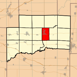 Location in Clinton County | |
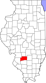 Clinton County's location in Illinois | |
| Coordinates: 38°36′35″N 89°21′32″W / 38.60972°N 89.35889°WCoordinates: 38°36′35″N 89°21′32″W / 38.60972°N 89.35889°W | |
| Country | United States |
| State | Illinois |
| County | Clinton |
| Established | November 4, 1873 |
| Area | |
| • Total | 20.67 sq mi (53.5 km2) |
| • Land | 17.83 sq mi (46.2 km2) |
| • Water | 2.84 sq mi (7.4 km2) 13.74% |
| Elevation | 449 ft (137 m) |
| Population (2010) | |
| • Estimate (2016)[1] | 3,863 |
| • Density | 220.5/sq mi (85.1/km2) |
| Time zone | UTC-6 (CST) |
| • Summer (DST) | UTC-5 (CDT) |
| ZIP codes | 62231 |
| FIPS code | 17-027-11241 |
Carlyle Township is one of fifteen townships in Clinton County, Illinois, USA. As of the 2010 census, its population was 3,932 and it contained 1,767 housing units.[2]
Geography
According to the 2010 census, the township has a total area of 20.67 square miles (53.5 km2), of which 17.83 square miles (46.2 km2) (or 86.26%) is land and 2.84 square miles (7.4 km2) (or 13.74%) is water.[2]
Cities, towns, villages
- Carlyle (vast majority)
Cemeteries
The township contains these cemeteries: Carlyle City Cemetery, Club Lake Grave Yard, Golder Grave Yard, Luebbers Grave Yard (now flooded), McAllister Grave Yard, Poor Farm Cemetery and St. Mary's Catholic Cemetery.[3]
Major highways
Rivers
Lakes
- Carlyle Lake [4]
- Horseshoe Lake
Landmarks
- Clinton County Fairgrounds
- Eldon Hazlet State Recreation Area
- Royal Lake Resort (northeast quarter)
Demographics
| Historical population | |||
|---|---|---|---|
| Census | Pop. | %± | |
| Est. 2016 | 3,863 | [1] | |
| U.S. Decennial Census[5] | |||
School districts
- Carlyle Community Unit School District 1
Political districts
- Illinois' 19th congressional district
- State House District 107
- State Senate District 54
References
- "Carlyle Township, Clinton County, Illinois". Geographic Names Information System. United States Geological Survey. Retrieved 2010-01-10.
- United States Census Bureau 2007 TIGER/Line Shapefiles
- United States National Atlas
- 1 2 "Population and Housing Unit Estimates". Retrieved June 9, 2017.
- 1 2 "Population, Housing Units, Area, and Density: 2010 - County -- County Subdivision and Place -- 2010 Census Summary File 1". United States Census. Retrieved 2013-05-28.
- ↑ "Archived copy". Archived from the original on 2010-08-01. Retrieved 2010-11-10.
- ↑ "Archived copy". Archived from the original on 2010-11-24. Retrieved 2010-11-10.
- ↑ "Census of Population and Housing". Census.gov. Retrieved June 4, 2016.
External links
Places adjacent to Carlyle Township, Clinton County, Illinois | |
|---|---|
Municipalities and communities of Clinton County, Illinois, United States | ||
|---|---|---|
| Cities | ||
| Villages | ||
| Townships | ||
| Unincorporated communities | ||
| Ghost town | ||
| Footnotes | ‡This populated place also has portions in an adjacent county or counties | |
This article is issued from
Wikipedia.
The text is licensed under Creative Commons - Attribution - Sharealike.
Additional terms may apply for the media files.