Dwarskersbos
| Dwarskersbos | |
|---|---|
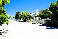 Beach House in Dwarskersbos | |
 Dwarskersbos  Dwarskersbos Dwarskersbos (South Africa)  Dwarskersbos Dwarskersbos (Africa) | |
| Coordinates: 32°42′S 18°14′E / 32.700°S 18.233°ECoordinates: 32°42′S 18°14′E / 32.700°S 18.233°E | |
| Country | South Africa |
| Province | Western Cape |
| District | West Coast |
| Municipality | Bergrivier |
| Established | 1920 |
| Area[1] | |
| • Total | 1.53 km2 (0.59 sq mi) |
| Population (2011)[1] | |
| • Total | 670 |
| • Density | 440/km2 (1,100/sq mi) |
| Racial makeup (2011)[1] | |
| • Black African | 29.9% |
| • Coloured | 9.7% |
| • Indian/Asian | 2.7% |
| • White | 57.5% |
| • Other | 0.1% |
| First languages (2011)[1] | |
| • Afrikaans | 94.5% |
| • English | 4.5% |
| • Other | 1.0% |
| Time zone | UTC+2 (SAST) |
| Area code | 022 |
| Website | www.dwarskersbos.com |

Sunset shot over a beach house in Dwarskersbos.
Dwarskersbos is a settlement in West Coast District Municipality in the Western Cape province of South Africa.
Fishing village some 11 km north of Laaiplek. Near here the Portuguese navigator Vasco da Gama first set foot on South African soil on 7 November 1497 when he explored the present St Helena Bay. A 6m high storm surge struck Dwarskersbos on 27 August 1969. The name is said to be derived from Afrikaans; kersbos is a type of plant, Euclea polyandra, or Sarcocaulon species.[2]
References
- 1 2 3 4 "Main Place Dwarskersbos". Census 2011.
- ↑ "Dictionary of Southern African Place Names (Public Domain)". Human Science Research Council. p. 148.
Municipalities and communities of West Coast District Municipality, Western Cape | ||
|---|---|---|
District seat: Moorreesburg | ||
| Matzikama | .svg.png) | |
| Cederberg | ||
| Bergrivier | ||
| Saldanha Bay | ||
| Swartland | ||
This article is issued from
Wikipedia.
The text is licensed under Creative Commons - Attribution - Sharealike.
Additional terms may apply for the media files.