Dumra
| Dumra | |
|---|---|
| town | |
 Dumra Location in Bihar, India | |
| Coordinates: 26°34′00″N 85°31′00″E / 26.5667271°N 85.5165482°ECoordinates: 26°34′00″N 85°31′00″E / 26.5667271°N 85.5165482°E | |
| Country |
|
| State | Bihar |
| District | Sitamarhi |
| Elevation | 86 m (282 ft) |
| Population (2001) | |
| • Total | 14,538 |
| Languages | |
| • Official | Maithili, Hindi |
| Time zone | UTC+5:30 (IST) |
| Vehicle registration | BR 30 |
| Lok Sabha constituency | Sitamarhi |
| Vidhan Sabha constituency | Sitamarhi |
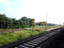
Dumra railway station
Sitamarhi
Dumra is a town and a notified area in Sitamarhi district in Bihar, India. Dumra is the headquarter of Sitamarhi district. It has approximately 16 wards.
There is a small railway station situated in Dumra.
Geography
Dumra is located at 25°01′N 83°58′E / 25.02°N 83.97°E. It has an average elevation of 86 metres (282 feet).
Demographics
As of 2001 India census,Dumra had a population of 14,538. Males constitute 57% of the population and females 43%. Dumra has an average literacy rate of 77%, higher than the national average of 59.5%: male literacy is 80% and, female literacy is 73%. In Dumra, 11% of the population is under 6 years of age.
Education
The following is a list of Schools in Sitamarhi, Bihar, India.
- Brilliant Public School Sitamarhi
- Delhi Public School Lagma
- Hellen's School Sitamarhi
- Janki Vidya Niketan
- Kamala-Girls High School
- Kendriya Vidyalaya
- Lakshmi High School
- N.S.D.A.V.Public School
- Mathura High School
- Sacred Heart School, Sitamarhi
- Saraswati Vidya Mandir, Ring bandh
References
This article is issued from
Wikipedia.
The text is licensed under Creative Commons - Attribution - Sharealike.
Additional terms may apply for the media files.