Areraj
| Areraj | |
|---|---|
| Town | |
 Areraj Location in Bihar, India | |
| Coordinates: 26°33′01″N 84°40′48″E / 26.55031°N 84.68013°ECoordinates: 26°33′01″N 84°40′48″E / 26.55031°N 84.68013°E | |
| Country |
|
| State | Bihar |
| District | Purvi Champaran |
| Population (2011) | |
| • Total | 26,014 |
| Languages | |
| • Official | Hindi, bhojpuri |
| Time zone | UTC+5:30 (IST) |
| Telephone code | 91 6258 |
| Lok Sabha constituency | Purvi Champaran |
| Vidhan Sabha constituency | Govindganj |
| Website |
eastchamparan |
Areraj is a town and a notified area in East Champaran district in the state of Bihar, India.
Geography
Areraj is located at 26°33′01″N 84°40′48″E / 26.55031°N 84.68013°E.
It is just 30KM away from Motihari. No train route is available to reach here, So to reach here one has to go by roadways only. Bus frequency is very good as after every 25minutes(approximately) there is one bus for Areraj. Its takes around 30-35 minutes to reach Areraj.
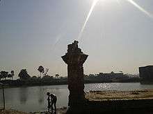
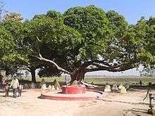
It's a famous religious place. Someshwar Nath temple is here, which is very very famous temple. In the month of Shravan (August), lot of Shiva's devotee come to visit this place & for whole month Officials have to make arrangements for the people as there is lot of rush during this auspicious month.
Rush increases even more on Monday and Friday, as these days are considered sacred day by Shiva's devotees. People believe that on these two days especially & in month of August particularly, whatever people wish to God is full filled.
Demographics
As of 2011 India census,[1] Areraj had a population of 26,014 with males constituting 52% of the population and females 48%. Areraj has an average literacy rate of 45%, lower than the national average of 59.5%; with 64% of males and 36% of females literate. 20% of the population is under 6 years of age.Areraj is going to connect on Indian Railway MAP through Hajipur-Sagauli proposed rail line.
References
- ↑ "Areraj Population, Caste Data Purba Champaran Bihar - Census India". www.censusindia.co.in. Retrieved 22 June 2018.