Cullahill Mountain
| Cullahill Mountain | |
|---|---|
| Culla Hills | |
| Highest point | |
| Elevation | 313 m (1,027 ft) |
| Listing | Marilyn |
| Coordinates | 52°48′01″N 7°28′26″W / 52.800245°N 7.473879°W |
| Geography | |
| Location |
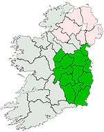
County Laois, |
| Topo map | OSi Discovery 68 |
Cullahill Mountain (Irish: Sliabh na Cúlchoille, meaning "Mountain of the Hazel Wood") is listed as a marilyn hill[1] and a Special Area of Conservation in County Laois, Ireland. Cullahill with an elevation of 313 m (1,027 ft) gives its name to the local townland.[2]
Cullahill Mountain takes its name from an ancient forest that covered the hill and extended down to Cullahill Castle and village of Cullahill. The first mention of the area was about 1460 where it was called "na Cúlchailli" and later in 1540 it was called "Cowlekyll".[2][3][4]
Cullahill Mountain contains a walking trail.[5] There is population of rare Green-winged Orchid and on the downslope there is an Ash and Hazel woodland. It is situated on the Castlecomer Plateau, along the main N8 road between Durrow in County Laois and Johnstown in County Kilkenny.
Geography
It forms the northern boundary to the valley running from Ballyragget to Freshford.[6] Cullahill Mountain lies on a western side of the Castlecomer Plateau.
Cullahill Mountain is listed as Special Area of Conservation[7] under the European Union Habitats Directive.[8] The site has a large population of Green-winged Orchid which is a rare species that is legally protected under the Irish governments Flora Protection Order (1987).
Most of vegetation at the site is herb-rich grassland over limestone. With about 5 grass species, 2 sedges and 20 broad-leaved herbs and allows a rich insect fauna to maintain itself. Grasses found include Quaking-grass, Crested Dog's-tail, Sheep's- fescue, Downy Oat-grass and Yellow Oat-grass.[7] Amongst these grasses is Mouse-ear Hawkweed, Wild Thyme, Bird's-foot-trefoil, Lady's Bedstraw, Carline Thistle, Mountain Everlasting, Purging Flax and Eyebright.[7]
The orchid flora of the grassland is notably rich, with Twayblade, Frog Orchid, Bee Orchid, Early-purple Orchid and Green-winged Orchid. The west side of site extends downslope to an Ash and Hazel woodland.[7]
Recreation
It is a scenic walking route called Cullahill mountain is through forests and farm land in partnership with Laois/Offaly Walking Partnership and Cullahill Rural Development Association.[9] The walk begins at Cullahill village,[10][11][12] and is a 10 km walk along field paths, forest tracks, lanes and minor roadways.[10]
Passing Cummer Well and a ring fort, it tracks the low hills above the village of Cullahill.[10] The walk provides views of the Slieve Bloom mountains to the north west, the Comeraghs and Galtees to the south west, and the Blackstairs and Wicklow Hills to the east.[5][10] Blackstairs, Keeper Hill and Slieve na mBan Mountains can be seen.[10]
See also
References
- ↑ (Clements & Payne 1998) Cullahill Mountain has been listed as a Marilyn since the latest publication of The Hewitts and Marilyns of Ireland.
- 1 2 "Sliabh na Cúlchoille/Cullahill Mountain". logainm.ie.
- ↑ (O'Sullivan & Ó Riain 1987, p. 34 Line 356)
- ↑ (White 1943, p. 135,333)
- 1 2 Somerville, Christopher (2011). "Walk of the Week: Cullahill mountain, Laois/Kilkenny - Independent.ie". Irish Independent.
- ↑ (Fraser 1844, p. 411)
- 1 2 3 4 Cullahill Mountain SAC (SAC IE0000831) "Cullahill Mountain SAC". NPWS. "Synopsis" (PDF). NPWS. "Objectives" (PDF). NPWS. "Natura 2000 Form" (PDF). NPWS. "Natura 2000 Data Form". European Environment Agency.
- ↑ "Special Areas of Conservation in County Kilkenny". Ireland: National Parks and Wildlife Service (NPWS).
- ↑ "District Strategic Plan Midlands Area (E3) 2011-2015" (PDF). coillte.ie. coillte.
- 1 2 3 4 5 "Cullahill". Laois Tourism.
- ↑ "Binnianea Looped Walk". discoverireland.ie. Archived from the original on 2016-05-10.
- ↑ Fewer, Michael (2012). "Go Walk: Cullahill Loop, Co Laois". Irish Times.
Further reading
- Clements, Clem; Payne, Tony (1998), "The Hewitts and Marilyns of Ireland — an update", The Angry Corrie, vol. 37, archived from the original on 2011-06-16 .
- Fraser, James (1844), A hand book for travellers in Ireland: descriptive of its scenery, towns, seats, antiquities, etc. with all the railways now open and various statistical tables (4 ed.), Dublin: James McGlashan .
- O'Sullivan, Anne; Ó Riain, Pádraig, eds. (1987). Poems on marcher lords : from a sixteenth-century Tipperary manuscript. London: Irish Texts Society. ISBN 9781870166539.
- White, Newport B., ed. (1943). Extents of Irish Monastic Possessions 1540-1541; from manuscripts in the Public Record Office, London. Dublin: Stationery Office for the Irish Manuscripts Commission.
External links
- "Map Trailhead 107 - Binninea Loop" (PDF).
- "Cullahill Mountain". openstreetmap.org.