Cruzeiro do Sul, Acre
| Cruzeiro do Sul, Acre | |||
|---|---|---|---|
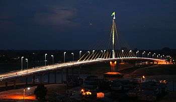 Union Bridge (Portuguese: Ponte da União) | |||
| |||
| Nickname(s): Land of the Nahuas (Portuguese: Terra dos Nauas) | |||
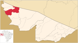 Location in Acre | |||
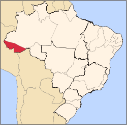
 Cruzeiro do Sul, Acre Location in Brazil | |||
| Coordinates: 7°37′51″S 72°40′12″W / 7.63083°S 72.67000°W | |||
| Country |
| ||
| Region | North | ||
| State | Acre | ||
| Founded | September 12, 1904 | ||
| Government | |||
| • Mayor | Ilderlei Cordeiro (PMDB) | ||
| Area | |||
| • Total | 7,924.943 km2 (3,059.838 sq mi) | ||
| Elevation | 182 m (597 ft) | ||
| Population (2012) | |||
| • Total | 79,819 | ||
| • Density | 10.07/km2 (26.1/sq mi) | ||
| Demonym(s) | cruzeirense [1] | ||
| Time zone | UTC-5 (ACT) | ||
| CEP postal code | 69980-000 | ||
| Area code | +55 68 | ||
| Website | cruzeirodosul.ac.gov.br | ||
.svg.png)
Cruzeiro do Sul (Portuguese pronunciation: [kɾuˈzejɾu du ˈsuw], Southern Cross) is a municipality located on the Juruá river in the west of the Brazilian state of Acre.
It is bordered to the north by the state of Amazonas, to the south by Peru, to the east by the municipality of Porto Walter, to the west by the municipality of Rodrigues Alves, to the northwest by the municipality of Tarauacá, and to the northwest by the municipality of Mâncio Lima.
The municipality contains 23% of the 846,633 hectares (2,092,080 acres) Serra do Divisor National Park, created in 1989.[2]
Economy
The principal economic activity of the municipality is rubber extraction. Of lesser importance is the farming of cassava, coffee and rice.
Transport
The town is served by Cruzeiro do Sul International Airport.
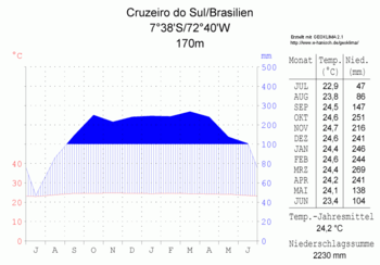
Climate
Gallery
.tif.png) Cruzeiro do Sul in 1909
Cruzeiro do Sul in 1909 Catedral Nossa Senhora da Glória
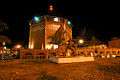 Catedral Nossa Senhora da Glória à noite
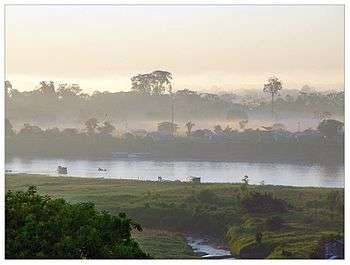 Rio Juruá crossing Cruzeiro do Sul
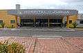 Juruá Hospital
References
- ↑ "IBGE - Cidades". O Brasil Município por Município. Brazilian Institute of Geography and Statistics (IBGE). Retrieved 2018-08-23.
- ↑ PARNA da Serra do Divisor (in Portuguese), ISA: Instituto Socioambiental, retrieved 2016-08-08
External links
| Wikimedia Commons has media related to Cruzeiro do Sul (Acre). |
- (in Portuguese) Bem-vindo à Cruzeiro do Sul
Coordinates: 7°37′51″S 72°40′12″W / 7.63083°S 72.67000°W