Bujari
Coordinates: 09°49′51″S 67°57′07″W / 9.83083°S 67.95194°W
| Bujari | |
|---|---|
 Bujari - Acre | |
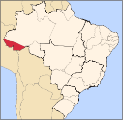
 Location of municipality in Acre State | |
| Coordinates: 9°49′51″S 67°57′07″W / 9.83083°S 67.95194°W | |
| Country |
|
| State | Acre |
| Government | |
| • Mayor | Romualdo de Souza Araujo (PCdoB) |
| Area | |
| • Total | 1,339 sq mi (3,468 km2) |
| Population (2007) | |
| • Total | 6,543 |
Bujari is a municipality located in the northeast of the Brazilian state of Acre. Its population is 6543 and its area is 3,468 km².
The municipality contains about 73% of the 46,064 hectares (113,830 acres) Antimary State Forest, a sustainable use conservation unit established in 1997.[1]
References
- ↑ FES do Antimary (in Portuguese), ISA:Instituto Socioambiental, retrieved 2016-07-02
This article is issued from
Wikipedia.
The text is licensed under Creative Commons - Attribution - Sharealike.
Additional terms may apply for the media files.