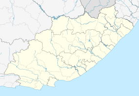
Clarkson, Eastern Cape
| Clarkson | |
|---|---|
 Clarkson  Clarkson Clarkson (South Africa)  Clarkson Clarkson (Africa) | |
| Coordinates: 34°00′36″S 24°20′28″E / 34.010°S 24.341°ECoordinates: 34°00′36″S 24°20′28″E / 34.010°S 24.341°E | |
| Country | South Africa |
| Province | Eastern Cape |
| District | Sarah Baartman |
| Municipality | Kou-Kamma |
| Area[1] | |
| • Total | 2.27 km2 (0.88 sq mi) |
| Population (2011)[1] | |
| • Total | 1,824 |
| • Density | 800/km2 (2,100/sq mi) |
| Racial makeup (2011)[1] | |
| • Black African | 40.3% |
| • Coloured | 58.4% |
| • Indian/Asian | 0.1% |
| • White | 0.2% |
| • Other | 1.0% |
| First languages (2011)[1] | |
| • Afrikaans | 63.3% |
| • Xhosa | 33.3% |
| • Sotho | 1.4% |
| • English | 1.2% |
| • Other | 0.9% |
| Time zone | UTC+2 (SAST) |
| PO box | 6302 |
| Area code | 042 |
Clarkson is a town in Kou-Kamma Local Municipality in the Eastern Cape province of South Africa.
Moravian Mission village in the former Humansdorp district, 26 km south-east of Assegaaibos station and 60 km west of Humansdorp. It was established by Bishop H P Halbeck in 1839 and named after Thomas Clarkson who helped abolish the slave-trade.[2]
References
- 1 2 3 4 "Main Place Clarkson". Census 2011.
- ↑ Raper, Peter E. (1987). Dictionary of Southern African Place Names. Internet Archive. p. 118. Retrieved 28 August 2013.
This article is issued from
Wikipedia.
The text is licensed under Creative Commons - Attribution - Sharealike.
Additional terms may apply for the media files.
.svg.png)