Prewitt, New Mexico
| Prewitt, New Mexico | |
|---|---|
| Unincorporated community | |
 Prewitt, New Mexico | |
| Coordinates: 35°21′46″N 108°02′38″W / 35.36278°N 108.04389°WCoordinates: 35°21′46″N 108°02′38″W / 35.36278°N 108.04389°W | |
| Country | United States |
| State | New Mexico |
| County | McKinley |
| Elevation | 6,827 ft (2,081 m) |
| Time zone | UTC-7 (Mountain (MST)) |
| • Summer (DST) | UTC-6 (MDT) |
| ZIP code | 87045 |
| Area code(s) | 505 |
| GNIS feature ID | 909850[1] |
Prewitt is an unincorporated community in McKinley County, New Mexico, United States.[1] Prewitt is located along Interstate 40 18.4 miles (29.6 km) northwest of Grants. Prewitt has a post office with ZIP code 87045.[2][3]
References
- 1 2 "Prewitt". Geographic Names Information System. United States Geological Survey.
- ↑ United States Postal Service (2012). "USPS - Look Up a ZIP Code". Retrieved 2012-02-15.
- ↑ "Postmaster Finder - Post Offices by ZIP Code". United States Postal Service. Retrieved August 24, 2013.
Municipalities and communities of McKinley County, New Mexico, United States | ||
|---|---|---|
| City | 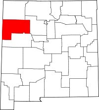 | |
| CDPs | ||
| Unincorporated communities | ||
| Indian reservation | ||
| Footnotes | ‡This populated place also has portions in an adjacent county or counties | |
This article is issued from
Wikipedia.
The text is licensed under Creative Commons - Attribution - Sharealike.
Additional terms may apply for the media files.