Christchurch Northern Motorway
| |
|---|---|
| State Highway 1 | |
| Route information | |
| Maintained by NZ Transport Agency | |
| Length | 10.2 km (6.3 mi) |
| Existed | 16 October 1967 – present |
| Major junctions | |
| From | Woodend |
|
State Highway 71 | |
| To | Belfast |
| Location | |
| Major cities | Kaiapoi |
| Highway system | |

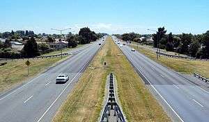
The Christchurch Northern Motorway is a motorway north of Christchurch, New Zealand, linking the northern Christchurch suburb of Belfast with Pineacres, between Woodend and Kaiapoi, bypassing the Kaiapoi area. The motorway is 10.2 kilometres (6.3 mi) in length, and is four-lane divided except for the two-lane undivided section between the Lineside Road/Smith Street interchange and the northern terminus. The motorway forms part of State Highway 1.
Route
The Christchurch Northern Motorway begins in the suburb of Belfast at an intersection with Main North Road about 10 km north of the Christchurch CBD with an interhcange with the Western Belfast Bypass nearby. For the first few kilometres it crosses the Waimakariri River and runs to the west of Kaiapoi with interchanges at Chaneys (with Main North Road), Tram Road and Ohoka Road. Approximately 7 km after the motorway begins is the Lineside Road interchange (providing access to Rangiora), where the motorway reduces to just two lanes undivided. The motorway ends further north at Pineacres, where it intersects with Main North Road again.
History
Plans for a motorway network in Christchurch were first revealed in 1962, with the release of the Christchurch Master Transportation Plan. Under this original plan the Northern Motorway was to run south from Chaneys, to the east of Belfast and Redwood and through Mairehau, St Albans and the CBD, to an interchange with the Christchurch Southern Motorway at Waltham.[1]
In the late-1960s a section of the Northern Motorway was constructed north from Belfast to Pineacres, a distance of about 10 km. Plans for extending the motorway towards the city were scaled back in 1975 so that the Northern Motorway would terminate at the northern edge of the CBD at Bealey Avenue. In the mid-1990s, the motorway designation through St Albans was removed, with the planned extension now terminating at Queen Elizabeth II Drive.[1]
A $4.6 million project to add new north facing on and off ramps to the Lineside Road interchange, to increase motorway accessibility north from Kaiapoi and relieve the dangerous Pineacres intersection, was completed in 2014.[2]
Beginning in 2015, the Western Belfast Bypass was constructed in order to remove traffic from the suburb of Belfast, New Zealand, where the motorway previously ended. The project was finished in late 2017 with it opening to traffic completely from December of that year onwards.
Future
Proposed projects associated with the Christchurch Northern Motorway, from north to south:
- Woodend Bypass - A proposed extension of the Northern Motorway from Pineacres to just north of Woodend. It would pass to the east of Woodend and to the west of Pegasus and would carry about 80 percent of the current 14,000 vehicles travelling through Woodend. The existing section of motorway between the Lineside Road interchange and Pineacres would be duplicated to four lanes. NZTA is currently seeking a designation for its preferred route. It is expected to be built in the next 10–15 years (reviewed periodically).[3]
- Pineacres Intersection Improvements - Subject to funding, improvements to the Pineacres intersection, at the northern end of the motorway, will be looked at when the Lineside Road Interchange project is complete. This work is likely to include the widening of the existing road and the construction of islands at the intersection to improve lane separation.[3]
- Christchurch Northern Corridor Extension - As part of the New Zealand Roads of National Significance Programme, the Christchurch Northern Motorway will be extended from Chaneys interchange to a roundabout on Cranford Street. This new motorway will bypass Belfast and Redwood to the east, and fly over QEII Drive with a full Diamond interchange.[4] An off road cycleway is also proposed between QEII Drive and Belfast Road. A contract was awarded in August 2016 for the $240 million motorway extension project. Construction commenced in October 2016 and is expected to take four years to complete.[5]
- Cranford Street Upgrade - Cranford Street will be upgraded to four lanes from the new motorway terminus to the Innes Road intersection as a Christchurch City Council delivered project.[6][5]
Major junctions
| Territorial authority | Location | km | Destinations | Notes |
|---|---|---|---|---|
| Waimakariri District | Pineacres | (Williams Street) – Pineacres, Kaiapoi | Christchurch Northern Motorway begins | |
| Kaiapoi | Smith Street – Kaiapoi | Full interchange | ||
| Ohoka Road – Kaiapoi, Rangiora | Full interchange (Northbound entrance using Cosgrove Road) | |||
| Tram Road – Ohoka, Oxford | Northbound exit and southbound entrance | |||
| 327.0 | Waimakariri River | |||
| Christchurch City | Chaneys | Main North Road – Kainga, Christchurch via Marshland | Southbound exit and northbound entrance | |
| Under construction Southbound exit and northbound entrance | ||||
| Belfast | Southbound exit and northbound entrance | |||
| Main North Road – Bridgend, Kainga, Chaneys Dickeys Road – Coutts Island | Christchurch Northern Motorway ends | |||
References
- 1 2 Christchurch City Centre, 40 years of Change, Traffic, Planning 1959-1999 (2000)
- ↑ "New Northern Motorway on-and-off ramps opened". NZ Transport Agency. 26 February 2014. Retrieved 22 June 2017.
- 1 2 "Woodend Corridor Improvements". NZ Transport Agency. Retrieved 24 November 2016.
- ↑ "Christchurch Northern Corridor". Retrieved 10 August 2016.
- 1 2 "$435 million investment in Christchurch's transport network". Nzta.govt.nz. 10 August 2016. Retrieved 10 August 2016.
- ↑ "Northern Arterial Extension, Cranford Street Upgrade and Cranford Basin Wetland Enhancement". Christchurch City Council. Archived from the original on 27 June 2013. Retrieved 2 July 2013.