Chipata
| Chipata | |
|---|---|
 | |
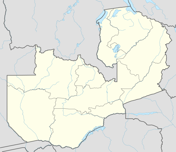 Chipata Location in Zambia | |
| Coordinates: 13°39′S 32°38′E / 13.650°S 32.633°E | |
| Country |
|
| Province | Eastern Province |
| District | Chipata District |
| Founded | 1899 |
| City status | 2017 |
| Government | |
| • Type | Local Government |
| • Mayor | Sinoya Mwale |
| Elevation | 3,740 ft (1,140 m) |
| Population (2010) | |
| • Total | 455,783 |
| • Density | 176/sq mi (68.1/km2) |
| Time zone | UTC+2 (CAT) |
| Climate | Aw |
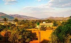
Chipata is a city in the Eastern part of Zambia. It was declared the 5th city of the country, after Lusaka, Ndola, Kitwe and Livingstone, by President Edgar Lungu on 24 February 2017, after a rampant economic and infrastructure growth of the town in the recent years.[1] With a population of about 455,783, Chipata, is believed to be the 3rd largest city of the country behind only Lusaka and Kitwe. Chipata is the capital of Eastern Province of Zambia. Having a modern market, a central hospital, shopping malls, a university, some colleges and a number of schools, Chipata is the business and administrative hub of the region. The town boasts a four star hotel, a golf course, an airport, a mosque, and a "welcome arch". Developed areas includes Kalongwezi, Moth, and Little Bombay.
Chipata is the regional head of the Ngoni of Zambia. The Ngoni adopted the languages of the tribes they conquered, so Chewa and Nsenga are the principal languages, although Tumbuka and English are widely spoken, plus some Indian languages, as a large number of Zambian Indians live in the town. It is located near the border with Malawi, and lies on the Great East Road which connects the capitals Lilongwe (130 km) and Lusaka (550 km). It is a popular access point for the South Luangwa National Park.
History
Chipata's name comes from the Ngoni word "Chimpata" meaning "large space," in reference to the town's situation in a shallow valley between hills. The name of the central neighbourhood of Kapata, the original centre of town, comes from the Ngoni word meaning "small space."
Chipata was formerly known as Fort Jameson (and informally as "Fort Jimmy"), being named after Leander Starr Jameson, the 19th-century British politician and adventurer. Even during the colonial period, few agreed that Jameson, who is mainly known for his part in the infamous Jameson Raid, fully deserved the honour of having any town named after him. Like 'Fort Manning' and 'Fort Rosebery', Fort Jameson was called a "fort" because the local government offices, the "boma", were once fortified.
Fort Jameson was the capital of the British protectorate of North-Eastern Rhodesia between 1900 and 1911.
Geography
Chipata is located in the Eastern Part of Zambia.
Suburbs
- Kalongwezi
- Kapata
- Umodzi
- Moth
- Muchini
- Nabvutika
- Little Bombay
- Mchenga
- Damview
- Old Jim
- New Jim
- Chimwemwe
- Magazine
- Eastrise
- Walela
- Chawama
- Munga
- Chipata Motel
- Nadalisika
- Katopola
- Referendum
- Rose
- Hillview
- Gash
- Msekera
- Messengers
Government
The mayor of the city of Chipata is the head of the city government.
Demographics
- Chewa
- Tumbuka
- Ngoni
- Nsenga
Economy
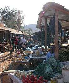
A significant amount of trade occurs between Zambia and Malawi via Chipata.The city also has a bustling down town area known as "Down Shops" which has a lot of shops and other businesses mainly run by Zambians of Indian Origin. Most notable shops are Kavulamungu Bargain Centre and Ally and Sons.
Tourism
The Nc'wala ceremony of the Ngoni people takes place at Mutenguleni on the outskirts of Chipata. The ceremony celebrates the first fruits harvest and is usually held at the end of February.
Education
Primary education
- Hillside Primary School
- Mpezeni Primary School
- Chipata Primary School
- Kapata Primary School
- Chongololo School
- St Anne's Primary School
Secondary education
- Anoya Zulu Secondary School
- Chizongwe Technical School
- St. Monicas Girls Secondary School
- Chipata Day Secondary School
- Hillside Girls High School
- St. Atanazio Secondary School
- St. Mary's Seminary School
Tertiary education
- Chipata Teacher's Training College
- Chipata Trades Training Institute
- Chipata School of Nursing
- DMI-St. Eugene University
Transport
A rail link to Chipata from Malawi (via Mchinji) opened in August 2011.[2] Chipata will now act as the Zambian railhead and entry point from Malawi and beyond. In the pipeline since 1982, the short link (about 35 km) provides a through-route for rail traffic from Zambia via Malawi to the Indian Ocean deepwater port at Nacala in Mozambique.[3] The route and alignment of the line has been laid out, including the site of Chipata station and the basic station building.[4] The route will provide an alternative to two existing rail routes to the Indian Ocean, at Dar es Salaam and Beira.[5]
In 2015 it was proposed to build a rail link to Serenje, a small town on the TAZARA Railway line.[6]
Climate
| Climate data for Chipata | |||||||||||||
|---|---|---|---|---|---|---|---|---|---|---|---|---|---|
| Month | Jan | Feb | Mar | Apr | May | Jun | Jul | Aug | Sep | Oct | Nov | Dec | Year |
| Record high °C (°F) | 32.1 (89.8) |
31.8 (89.2) |
32.4 (90.3) |
32.7 (90.9) |
32.2 (90) |
29.9 (85.8) |
29.9 (85.8) |
33.0 (91.4) |
36.1 (97) |
37.5 (99.5) |
38.0 (100.4) |
34.9 (94.8) |
38.0 (100.4) |
| Average high °C (°F) | 27.2 (81) |
27.4 (81.3) |
27.8 (82) |
27.6 (81.7) |
26.6 (79.9) |
25.0 (77) |
24.9 (76.8) |
27.1 (80.8) |
30.3 (86.5) |
32.1 (89.8) |
31.2 (88.2) |
28.1 (82.6) |
27.9 (82.2) |
| Daily mean °C (°F) | 22.1 (71.8) |
22.0 (71.6) |
22.0 (71.6) |
21.4 (70.5) |
20.0 (68) |
18.2 (64.8) |
18.1 (64.6) |
20.4 (68.7) |
23.9 (75) |
25.6 (78.1) |
24.9 (76.8) |
22.6 (72.7) |
21.8 (71.2) |
| Average low °C (°F) | 18.2 (64.8) |
18.0 (64.4) |
17.9 (64.2) |
16.7 (62.1) |
14.2 (57.6) |
11.7 (53.1) |
11.8 (53.2) |
14.2 (57.6) |
17.7 (63.9) |
19.9 (67.8) |
19.6 (67.3) |
18.6 (65.5) |
16.5 (61.7) |
| Record low °C (°F) | 13.2 (55.8) |
13.2 (55.8) |
11.8 (53.2) |
9.7 (49.5) |
6.5 (43.7) |
3.3 (37.9) |
4.0 (39.2) |
3.7 (38.7) |
7.2 (45) |
12.4 (54.3) |
12.8 (55) |
13.3 (55.9) |
3.3 (37.9) |
| Average precipitation mm (inches) | 252.7 (9.949) |
225.4 (8.874) |
166.9 (6.571) |
49.6 (1.953) |
4.4 (0.173) |
1.1 (0.043) |
0.3 (0.012) |
0.0 (0) |
0.8 (0.031) |
13.1 (0.516) |
81.9 (3.224) |
220.7 (8.689) |
1,016.9 (40.035) |
| Average precipitation days (≥ 1.0 mm) | 20 | 18 | 14 | 7 | 0 | 0 | 0 | 0 | 0 | 1 | 9 | 19 | 88 |
| Average relative humidity (%) | 80.7 | 81.5 | 78.8 | 72.1 | 64.4 | 59.8 | 55.9 | 48.9 | 42.7 | 45.2 | 56.6 | 75.4 | 63.5 |
| Mean monthly sunshine hours | 158.1 | 148.4 | 201.5 | 234.0 | 266.6 | 258.0 | 260.4 | 275.9 | 276.0 | 269.7 | 216.0 | 167.4 | 2,732 |
| Source: NOAA[7] | |||||||||||||
See also
References
- ↑ "Chipata: Newest city on the hills". 25 February 2017. Retrieved 3 December 2017.
- ↑ http://www.afrol.com/articles/36610
- ↑ "New rail link to boost Southern African trade." Mail & Guardian. Archived 2007-09-30 at the Wayback Machine.
- ↑ Google Earth has high resolution photos of the station at lat. -13.671, long. 32.642.
- ↑ http://www.rra.co.za/media.cgi?id=7186&action=easyprint%5Bdead+link%5D
- ↑ http://www.railwaysafrica.com/news/article/linking-chipata-to-tazara
- ↑ "Chipata MET Climate Normals 1961–1990". National Oceanic and Atmospheric Administration. Retrieved March 8, 2015.
External links
| Wikivoyage has a travel guide for Chipata. |
Coordinates: 13°39′00″S 32°38′00″E / 13.65000°S 32.63333°E
Largest cities or towns in Zambia According to the 2010 Census | |||||||||
|---|---|---|---|---|---|---|---|---|---|
| Rank | Name | Province | Pop. | Rank | Name | Province | Pop. | ||
Lusaka  Kitwe |
1 | Lusaka | Lusaka | 1,747,152 | 11 | Solwezi | North-Western | 90,856 | 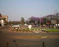 Ndola |
| 2 | Kitwe | Copperbelt | 501,360 | 12 | Mansa | Luapula | 78,153 | ||
| 3 | Ndola | Copperbelt | 451,246 | 13 | Chililabombwe | Copperbelt | 77,818 | ||
| 4 | Kabwe | Central | 202,360 | 14 | Mazabuka | Southern | 71,700 | ||
| 5 | Chingola | Copperbelt | 185,246 | 15 | Kafue | Lusaka | 71,573 | ||
| 6 | Mufulira | Copperbelt | 151,309 | 16 | Kalulushi | Copperbelt | 51,863 | ||
| 7 | Livingstone | Southern | 134,349 | 17 | Choma | Southern | 51,842 | ||
| 8 | Luanshya | Copperbelt | 130,076 | 18 | Mongu | Western | 49,818 | ||
| 9 | Chipata | Eastern | 116,627 | 19 | Kapiri Mposhi | Central | 44,783 | ||
| 10 | Kasama | Northern | 101,845 | 20 | Nakonde | Muchinga | 41,836 | ||
| Authority control |
|---|