Kasama, Zambia
| Kasama | |
|---|---|
| Nickname(s): Aba saamike akatambala ku chimuti | |
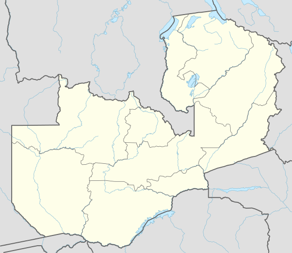 Kasama Location in Zambia | |
| Coordinates: 10°12′42″S 31°10′42″E / 10.21167°S 31.17833°E | |
| Country |
|
| Province | Northern Province |
| District | Kasama District |
| Elevation | 4,508 ft (1,374 m) |
| Population (2010 census) | |
| • Total | 101,845 |
| Time zone | UTC+2 (CAT) |
| Climate | Cwa |
Kasama is a city in the Northern Province of Zambia. It serves as the provincial capital and the headquarters of Kasama District.[1]
Location
It is situated on the central-southern African plateau, approximately 856 kilometres (532 mi), by road, north-east of Lusaka, the capital and largest city in Zambia.[2]
Kasama is located on the Great North Road from Mpika through Kasama to Mbala and on to Mpulungu, at the tip of Lake Tanganyika. The geographical coordinates of the city are 10°12'42.0"S, 31°10'42.0"E (Latitude:-10.211667; Longitude:31.178333).[3] The city lies at an average elevation of 1,374 metres (4,508 ft), above sea-level.[4]
Population
The city population grew considerably in the 1970s and 1980s after construction of the TAZARA Railway through the city, and the tarring of the Great North Road. Its population, according to Encyclopedia Britannica, was 74,243 in 2000 and had increased to 113,779 in 2010.[5]
Overview
Kasama is in the heartland of the Bemba ethnic group,[1] whose Paramount Chief Chitimukulu maintains his headquarters 9 kilometres (6 mi) from Malole, which is 51 kilometres (32 mi) east of the city center.[6]
In 1898/1899 a crisis over the succession of the Chitimukulu led to Bishop Joseph 'Moto Moto' Dupont gaining the agreement of Bemba chiefs to the British colonial Administrator of North-Eastern Rhodesia, Robert Codrington taking control of the area. Codrington established a boma at Kasama and the town's central location as well as its closeness to Chitimukulu's court led to it eventually becoming the largest and dominant town of the north-eastern lobe of what became Northern Rhodesia, then later, Zambia.
Economic activities
The town has a few modern facilities, among them are a Shoprite Checkers branch, budget stores, a local supermarket called PJT and four bakeries. The town has branches of Zambian commercial banks including Zambia National Commercial Bank, National Savings & Credit Bank, Atlas Mara Bank Zambia Limited, Standard Chartered Zambia, Cavmont Bank, Barclays Bank of Zambia and Indo-Zambia Bank Limited. The town has VISA and ATM services.[1]
Most people in Kasama are not formally employed and they run small businesses to earn a living. Kasama has around six internet cafes where people can access internet services. The hospital is the Kasama General Hospital, that provides locals with health services. The city has a police station and several police posts. The available mobile telephone operators include MTN Group, Airtel Zambia and CellZ.[1]
Suburbs
Kasama has the following residential compounds within the district council boundaries:
- Central Town (the largest)
- New Town or Mbulo
- Location
- Mukulumpe
- Chikumanino
The compounds below are out of the council boundary:
- Mulenga Hills
- Jazz
- Tazara
- Misamfu
- Milima
- Chiba
- Chitamba
- Brown
- Winberg
- Kasama
- Kungu
- Mutale/Milenge
- Chisanga
- Soft Katongo
- Lua Luo
Transport
Kasama is served by a good network of major highways, including (a) Kasama–Mpika Highway (b) Kasama–Mbala Highway (which are part of Zambia's Great North Road), (c) Kasama–Luwingu Highway and (d) Kasama–Isoka Highway.[3]
The 1,067 mm (3 ft 6 in) gauge TAZARA Railway connects Tanzania to the north via Kasama, with Zambia Railways at Kapiri Mposhi to the south.
Air transport is accessible through Kasama Airport. It can accommodate small aircraft, and it is undergoing an upgrade to be able to accommodate larger aircraft. It was expected to be ready by the end of 2017.[7]
Recreation
Kasama recreational facilities include the Kasama golf club, which also offers tennis, volleyball, badminton, body building, and a small football ground with one stand that can seat less than a thousand people. The town has other football grounds where people can play soccer.
There are resorts at Chishimba Falls and guest houses and lodges such as the Chinchi's Nest and Kings Guest House, and 3 nightclubs.
Climate
| Climate data for Kasama | |||||||||||||
|---|---|---|---|---|---|---|---|---|---|---|---|---|---|
| Month | Jan | Feb | Mar | Apr | May | Jun | Jul | Aug | Sep | Oct | Nov | Dec | Year |
| Record high °C (°F) | 30.5 (86.9) |
31.2 (88.2) |
31.5 (88.7) |
31.2 (88.2) |
31.3 (88.3) |
30.6 (87.1) |
30.0 (86) |
32.4 (90.3) |
36.5 (97.7) |
35.6 (96.1) |
34.8 (94.6) |
32.0 (89.6) |
36.5 (97.7) |
| Average high °C (°F) | 26.3 (79.3) |
26.8 (80.2) |
26.8 (80.2) |
26.5 (79.7) |
26.0 (78.8) |
24.9 (76.8) |
24.9 (76.8) |
26.9 (80.4) |
29.8 (85.6) |
30.9 (87.6) |
28.9 (84) |
26.7 (80.1) |
27.1 (80.8) |
| Daily mean °C (°F) | 19.7 (67.5) |
19.9 (67.8) |
20.2 (68.4) |
20.2 (68.4) |
18.9 (66) |
17.2 (63) |
17.1 (62.8) |
18.9 (66) |
21.8 (71.2) |
23.1 (73.6) |
21.6 (70.9) |
20.1 (68.2) |
19.9 (67.8) |
| Average low °C (°F) | 16.1 (61) |
16.2 (61.2) |
16.1 (61) |
15.2 (59.4) |
12.5 (54.5) |
9.6 (49.3) |
9.3 (48.7) |
11.0 (51.8) |
13.8 (56.8) |
15.9 (60.6) |
16.4 (61.5) |
16.2 (61.2) |
14.0 (57.2) |
| Record low °C (°F) | 8.2 (46.8) |
13.3 (55.9) |
12.2 (54) |
9.8 (49.6) |
2.4 (36.3) |
1.0 (33.8) |
2.5 (36.5) |
4.7 (40.5) |
8.5 (47.3) |
11.4 (52.5) |
12.6 (54.7) |
10.9 (51.6) |
1.0 (33.8) |
| Average precipitation mm (inches) | 285.3 (11.232) |
242.8 (9.559) |
233.1 (9.177) |
91.3 (3.594) |
10.5 (0.413) |
0.4 (0.016) |
0.1 (0.004) |
0.1 (0.004) |
3.0 (0.118) |
23.3 (0.917) |
158.3 (6.232) |
295.0 (11.614) |
1,343.2 (52.882) |
| Average precipitation days (≥ 1.0 mm) | 23 | 20 | 20 | 8 | 1 | 0 | 0 | 0 | 0 | 3 | 14 | 24 | 113 |
| Average relative humidity (%) | 82.7 | 82.3 | 82.1 | 77.3 | 69.5 | 63.2 | 57.6 | 51.9 | 44.4 | 50.2 | 67.4 | 80.6 | 67.4 |
| Mean monthly sunshine hours | 133.3 | 134.4 | 179.8 | 222.0 | 288.3 | 297.0 | 306.9 | 306.9 | 279.0 | 251.1 | 207.0 | 151.9 | 2,757.6 |
| Source: NOAA[8] | |||||||||||||
World War I
At the end of World War I, when it consisted of a handful of government offices and a dozen stores, it was evacuated by its British population of a couple of dozen in the face of a surprise raid from the north-east by German East African forces under General Paul von Lettow-Vorbeck. Not knowing that the armistice had occurred in Europe the day before, the Germans took the abandoned town on November 12, 1918 and continued south-west (there was no battle at Kasama since the British imperial forces were at Abercorn), agreeing a cease-fire at the Chambeshi River on November 14 when they were informed of the German surrender in Europe. For further details, see Von Lettow-Vorbeck Memorial.
Art
It is known for the Stone Age rock art in the surrounding area. The Chishimba Falls also lie near the town.
See also
References
| Wikivoyage has a travel guide for Kasama. |
- 1 2 3 4 Zambia-Advisor.com (4 October 2018). "About Kasama Town, Northern Province, Zambia". Zambia-Advisor.com. Retrieved 4 October 2018.
- ↑ Globefeed.com (4 October 2018). "Distance between Lusaka, Zambia and Kasama, Zambia". Globefeed.com. Retrieved 4 October 2018.
- 1 2 Google (4 October 2018). "Location of Kasama, Northern Province, Zambia" (Map). Google Maps. Google. Retrieved 4 October 2018.
- ↑ Floodmap.net (4 October 2018). "Elevation of Kasama, Zambia". Floodmap.net. Retrieved 4 October 2018.
- ↑ The Editors of Encyclopaedia Britannica (4 October 2018). "Population of Kasama Town, Zambia". Chicago, Illinois, United States: Encyclopedia Britannica. Retrieved 4 October 2018.
- ↑ Globefeed.com (4 October 2018). "Distance between Kasama, Zambia and Malole, Zambia". Globefeed.com. Retrieved 4 October 2018.
- ↑ Sinyangwe, Henry (25 November 2016). "Kasama: Mix of cultural heritage, rapid economic growth". Zambia Daily Mail. Lusaka. Retrieved 4 October 2015.
- ↑ "Kasama MET Climate Normals 1961–1990". National Oceanic and Atmospheric Administration. Retrieved April 5, 2015.
| Authority control |
|---|