Chester (village), New York
| Chester | |
|---|---|
| Village | |
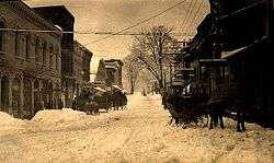
 View south along Main Street | |
| Etymology: From city in England | |
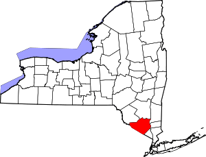
_highlighted.svg.png) Location in Orange County and the state of New York. | |
.svg.png) Location of New York in the United States | |
| Coordinates: 41°21′27″N 74°16′32″W / 41.35750°N 74.27556°WCoordinates: 41°21′27″N 74°16′32″W / 41.35750°N 74.27556°W | |
| Country | United States |
| State | New York |
| County | Orange |
| Founded | 1892 |
| Government | |
| • Type | Village Hall, 47 Main Street |
| • Mayor | Tom Bell |
| Area | |
| • Total | 2.1 sq mi (5 km2) |
| Highest elevation (Unnamed hill in S of village) | 572 ft (174 m) |
| Lowest elevation | 420 ft (130 m) |
| Population (2010) | |
| • Total | 3,969 |
| • Estimate (2016)[1] | 3,957 |
| Time zone | UTC-5 (Eastern (EST)) |
| • Summer (DST) | UTC-4 (EDT) |
| ZIP Code | 10918 |
| Area code(s) | 845 |
| FIPS Code | 36-15297 |
| GNIS feature ID | 0946539 |
| Wikimedia Commons | Chester, Orange County, New York |
| Website | Village of Chester New York |
Chester is a village in Orange County, New York, United States. The population was 3,969 at the 2010 census. It was named after the City of Chester in England. Chester is part of the Poughkeepsie–Newburgh–Middletown, NY Metropolitan Statistical Area as well as the larger New York–Newark–Bridgeport, NY-NJ-CT-PA Combined Statistical Area.
The Village of Chester is primarily located in the northern part of the Town of Chester.
History
The village of Chester was incorporated in 1892. At the center of a dairy industry, the village claims to be the birthplace of Philadelphia Cream Cheese. Other brands produced in Chester were Clover Brand, Cow Brand, D’isigny, Fromage De Brie, Neufchatel, Star Brand and World Brand.[2]
The village of Chester is considered Downtown Historic Chester where the Orange Heritage rail trail beings at the site of the former Erie Railroad train station.
Geography
The village of Chester is located at 41°21′26″N 74°16′31″W / 41.35722°N 74.27528°W (41.357378, -74.275488).[3] and has a total area of 2.1 square miles (5.5 km²).
Highway access is provided by NY-94. Goose Pond Mountain State Park is southeast of the village.
Demographics
| Historical population | |||
|---|---|---|---|
| Census | Pop. | %± | |
| 1870 | 686 | — | |
| 1900 | 1,250 | — | |
| 1910 | 1,210 | −3.2% | |
| 1920 | 1,049 | −13.3% | |
| 1930 | 1,154 | 10.0% | |
| 1940 | 1,140 | −1.2% | |
| 1950 | 1,215 | 6.6% | |
| 1960 | 1,492 | 22.8% | |
| 1970 | 1,627 | 9.0% | |
| 1980 | 1,910 | 17.4% | |
| 1990 | 3,270 | 71.2% | |
| 2000 | 3,445 | 5.4% | |
| 2010 | 3,969 | 15.2% | |
| Est. 2016 | 3,957 | [1] | −0.3% |
| U.S. Decennial Census[4] | |||
As of the census[5] of 2000, there were 3,445 people, 1,396 households, and 901 families residing in the village. The population density was 1,628.0 people per square mile (627.4/km²). There were 1,455 housing units at an average density of 687.6 per square mile (265.0/km²). The racial makeup of the village was 83.45% White, 7.72% Black or African American, 0.93% Native American, 2.96% Asian, 2.61% from other races, and 2.32% from two or more races. Hispanic or Latino of any race were 10.16% of the population.

There were 1,396 households out of which 30.7% had children under the age of 18 living with them, 50.8% were married couples living together, 10.5% had a female householder with no husband present, and 35.4% were non-families. 28.0% of all households were made up of individuals and 8.2% had someone living alone who was 65 years of age or older. The average household size was 2.45 and the average family size was 3.04.
In the village, the population was spread out with 23.5% under the age of 18, 7.3% from 18 to 24, 36.7% from 25 to 44, 21.6% from 45 to 64, and 10.9% who were 65 years of age or older. The median age was 36 years. For every 100 females, there were 92.4 males. For every 100 females age 18 and over, there were 89.0 males.
The median income for a household in the village was $55,417, and the median income for a family was $65,321. Males had a median income of $47,386 versus $31,957 for females. The per capita income for the village was $24,960. About 4.2% of families and 6.0% of the population were below the poverty line, including 7.7% of those under age 18 and 7.8% of those age 65 or over.
Notable people
- William Terry Jackson, former US Congressman
- Andy Grammer, singer/songwriter
References
- 1 2 "Population and Housing Unit Estimates". Retrieved June 9, 2017.
- ↑ Discovering the Wheys and Means of Chester's Cheese History Archived March 6, 2012, at the Wayback Machine.
- ↑ "US Gazetteer files: 2010, 2000, and 1990". United States Census Bureau. 2011-02-12. Retrieved 2011-04-23.
- ↑ "Census of Population and Housing". Census.gov. Archived from the original on May 12, 2015. Retrieved June 4, 2015.
- ↑ "American FactFinder". United States Census Bureau. Archived from the original on 2013-09-11. Retrieved 2008-01-31.
External links
| Wikimedia Commons has media related to Chester, Orange County, New York. |
- Village website
- Chester Historical Society Digital Collections
- Discovering the wheys and means of Chester’s cheese history
- The Chronicle, community newspaper