Chester, Orange County, New York
| Chester | |
|---|---|
| Town | |
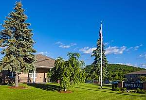 Town hall | |
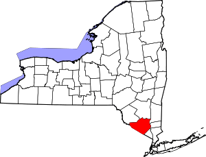
 Location in Orange County and the state of New York. | |
 Chester Location of Chester in New York | |
| Coordinates: 41°21′25″N 74°16′37″W / 41.35694°N 74.27694°WCoordinates: 41°21′25″N 74°16′37″W / 41.35694°N 74.27694°W | |
| Country | United States |
| State | New York |
| County | Orange |
| Settled | 1721 |
| Established | 1845 |
| Government | |
| • Type | Town Council |
| • Town Supervisor | Alex Jamieson (R) |
| • Town Council |
Members' List
|
| Area[1] | |
| • Total | 25.20 sq mi (65.27 km2) |
| • Land | 25.05 sq mi (64.88 km2) |
| • Water | 0.15 sq mi (0.39 km2) |
| Population (2010)[2] | |
| • Total | 11,981 |
| • Estimate (2016)[3] | 11,944 |
| • Density | 476.83/sq mi (184.10/km2) |
| FIPS code | 36-071-15308 |
| Website | www.chester-ny.gov |
Chester is a town in Orange County, New York, United States. The population was 11,981 at the 2010 census.[2] Chester contains a village, also called Chester.
Chester is the birthplace of Philadelphia-style cream cheese.[4]
History
The town was first settled in the 1700s by Europeans.[5]
The economy of the early town was based on dairy products, particularly milk, which was brought on by the completion of the Erie Railroad, which ran through Chester, in 1841. After its completion, local farmer Phil Gregory would ship 240 quarts (230 l) of milk to New York City, which earned the railroad $1.20 ($28 in modern dollars[6] ) in freight charges; Gregory's business eventually grew to 300,000 quarts (280,000 l) of milk a day, which in turn gave the railroad over $1,000 ($24,000 in modern dollars[6] ) in profit.[5]
In 2018, after a large development that had been approved turned out to be aimed toward the Satmar Hasidim community whose rapid growth has been the source of considerable unrest between nearby Kiryas Joel and neighboring communities, town supervisor Alex Jamieson told a local newspaper that the town would be buying up areas of undeveloped open space, including around the planned development in Chester "to keep the Hasidic out so that they can't control the Town Board." His comments were widely reported and criticized as antisemitic.[7][8]
Geography
According to the United States Census Bureau, the town has a total area of 25.2 square miles (65.4 km²), of which, 25.2 square miles (65.2 km2) of it is land and 0.1 square miles (0.2 km2) of it (0.24%) is water.
Conjoined NY-17 and US-6 cross the north part of Chester. NY-94 crosses NY-17 south of Chester village.
Demographics
| Historical population | |||
|---|---|---|---|
| Census | Pop. | %± | |
| 1850 | 1,641 | — | |
| 1860 | 1,849 | 12.7% | |
| 1870 | 2,113 | 14.3% | |
| 1880 | 2,229 | 5.5% | |
| 1890 | 2,112 | −5.2% | |
| 1900 | 2,186 | 3.5% | |
| 1910 | 2,001 | −8.5% | |
| 1920 | 1,803 | −9.9% | |
| 1930 | 2,164 | 20.0% | |
| 1940 | 2,776 | 28.3% | |
| 1950 | 2,878 | 3.7% | |
| 1960 | 3,494 | 21.4% | |
| 1970 | 4,767 | 36.4% | |
| 1980 | 6,850 | 43.7% | |
| 1990 | 9,138 | 33.4% | |
| 2000 | 12,140 | 32.9% | |
| 2010 | 11,981 | −1.3% | |
| Est. 2016 | 11,944 | [3] | −0.3% |
| U.S. Decennial Census[9] | |||
As of the census[2] of 2000, there were 12,140 people, 3,848 households, and 3,016 families residing in the town. The population density was 482.2 people per square mile (186.2/km²). There were 3,984 housing units at an average density of 158.3 per square mile (61.1/km²). The racial makeup of the town was 87.18% White, 6.62% Black or African American, 0.34% Native American, 2.66% Asian, 0.05% Pacific Islander, 1.93% from other races, and 1.22% from two or more races. Hispanic or Latino of any race were 10.14% of the population.
There were 3,848 households out of which 41.5% had children under the age of 18 living with them, 66.7% were married couples living together, 8.2% had a female householder with no husband present, and 21.6% were non-families. 16.9% of all households were made up of individuals and 4.9% had someone living alone who was 65 years of age or older. The average household size was 2.92 and the average family size was 3.31.
In the town, the population was spread out with 27.4% under the age of 18, 5.6% from 18 to 24, 33.8% from 25 to 44, 25.7% from 45 to 64, and 7.7% who were 65 years of age or older. The median age was 37 years. For every 100 females, there were 111.8 males. For every 100 females age 18 and over, there were 112.0 males.
The median income for a household in the town was $69,280, and the median income for a family was $75,222. Males had a median income of $53,528 versus $36,673 for females. The per capita income for the town was $25,900. About 2.7% of families and 7.2% of the population were below the poverty line, including 4.9% of those under age 18 and 3.7% of those age 65 or over.
Communities and locations in the Town of Chester
- Camp Monroe – a multi denominational Jewish sleepaway summer camp founded in 1941 near the southern border with the Town of Monroe.
- Chester – A village located on NY-94.
- East Chester – A hamlet southeast of Chester village.
- Greycourt – Now mostly vacant land, located east of Chester village, it was once a major railroad intersection and depot on the Erie Main Line.
- Glenmere Lake – A reservoir at the west town line
- Goose Pond Mountain State Park – A state park southeast of Chester village.
- Lake Hill Farms– A subdivision of about 175 homes in the southwest corner of the town first developed in 1973.
- Sugar Loaf – The oldest community in the town, predating Chester town by more than a century (1738). The hamlet is home to the famous harness racing horse Hambletonian 10.
- Surrey Meadows – A late 1960s subdivision north of Chester village. The elementary school is located in this area.
- Walton Park – A hamlet on the border of Chester and Monroe towns.
See also
References
- ↑ "2016 U.S. Gazetteer Files". United States Census Bureau. Retrieved Jul 5, 2017.
- 1 2 3 "American FactFinder". United States Census Bureau. Retrieved 2008-01-31.
- 1 2 "Population and Housing Unit Estimates". Retrieved June 9, 2017.
- ↑ "Philadelphia Cream Cheese Aims to Move Beyond the Bagel". The New York Times. 3 April 2011.
- 1 2 "Historian". chester-ny.gov. Retrieved September 12, 2015.
- 1 2 Federal Reserve Bank of Minneapolis Community Development Project. "Consumer Price Index (estimate) 1800–". Federal Reserve Bank of Minneapolis. Retrieved January 2, 2018.
- ↑ Easley, Hema (September 17, 2018). "Chester supervisor's Hasidic comments draw criticism". Times-Herald Record. Retrieved September 26, 2018.
- ↑ "New York Town is Buying Up Property To Keep Hasidic Jews Out". The Forward. September 16, 2018.
- ↑ "Census of Population and Housing". Census.gov. Archived from the original on May 12, 2015. Retrieved June 4, 2015.
External links
| Wikimedia Commons has media related to Chester, Orange County, New York. |