Chehlan Wala
| Chehlan Wala ਚਹਿਲਾਂ ਵਾਲ਼ਾ | |
|---|---|
| Village | |
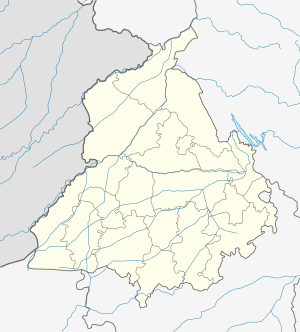
 Chehlan Wala Location in Punjab, India  Chehlan Wala Chehlan Wala (India) | |
| Coordinates: 29°57′07″N 75°13′01″E / 29.952°N 75.217°ECoordinates: 29°57′07″N 75°13′01″E / 29.952°N 75.217°E | |
| Country |
|
| State | Punjab |
| District | Mansa |
| Talukas | Sardulgarh |
| Government | |
| • Type | Panchayati raj (India) |
| • Body | Gram panchayat |
| Languages | |
| • Official | Punjabi |
| • Regional | Punjabi |
| Time zone | UTC+5:30 (IST) |
| Nearest city | Talwandi Sabo |
Chehlan Wala (also spelled as Chahlan Wal or Chehlanwala) is a village in Sardulgarh tehsil of Mansa district in Punjab, India.[1] The village was on the list for more than 90% of voting in the February 2012 elections.[2][3]
Geography
The village is approximately centered at 29°57′07″N 75°13′01″E / 29.95194°N 75.21694°E.[4] Kamalu, Behniwal and Bana Wala are the surrounding villages.
See also
References
- ↑ "Cong policies anti-Sikh, says Badal". News in English. The Tribune. 12 April 2009. Retrieved 24 June 2012.
- ↑ "ਪੋਲਿੰਗ ਫ਼ੀਸਦ ਵਿੱਚ ਮਾਨਸਾ ਦੇ ਪਿੰਡਾਂ ਨੇ ਬਾਜ਼ੀ ਮਾਰੀ". News in Punjabi. Punjabi Tribune. 2 February 2012. Retrieved 24 June 2012.
- ↑ "ਵਿਧਾਨ ਸਭਾ ਚੋਣਾਂ ਵਿਚ ਪਿਛੜੇ ਖੇਤਰ ਵਿਚ ਲੋਕਾਂ ਨੇ ਦਿੱਤਾ ਰਾਜਨੀਤਿਕ ਚੇਤਨਾ ਦਾ ਸਬੂਤ". News in Punjabi. PunjabNewsline.in. 3 February 2012. Archived from the original on 6 February 2012. Retrieved 24 June 2012.
- ↑ Google Maps
This article is issued from
Wikipedia.
The text is licensed under Creative Commons - Attribution - Sharealike.
Additional terms may apply for the media files.