Lakhmir Wala
| Lakhmir Wala ਲਖਮੀਰ ਵਾਲ਼ਾ | |
|---|---|
| Village | |
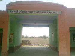 A view of the local primary school | |
 Lakhmir Wala Location in Punjab, India  Lakhmir Wala Lakhmir Wala (India) | |
| Coordinates: 29°51′36″N 75°23′35″E / 29.860°N 75.393°ECoordinates: 29°51′36″N 75°23′35″E / 29.860°N 75.393°E | |
| Country |
|
| State | Punjab |
| District | Mansa |
| Languages | |
| • Official | Punjabi |
| • Regional | Punjabi |
| Time zone | UTC+5:30 (IST) |
| PIN | 151505 |
| Telephone code | 01659 |
| Nearest city | Jhunir |
Lakhmir Wala (sometimes spelled as Lakhmeerwala) is a village in the Mansa district of Indian Punjab.[1][2][3]
Geography
It's centered approximately at 29°51′36″N 75°23′35″E / 29.86000°N 75.39306°E,[4] located at only 19 km from Mansa and 10 km from Jhunir. Chachohar, Kot Dharmu, Bhamme Khurd, Akkan Wali[2] and Khiali Chehlan Wali are the nearby villages.
Culture
Punjabi is the mother tongue as well as the official language here. The Jatt clan of the village includes, Jagal, Chahal, Brar Sidhu Bhathal and Sandhu BHATTI.
Religion
By religion, the village is predomintated by the Sikhs, the follower of Sikhism with Hindu and Muslim minorities.
Demographics
According to the 2001 census, the village has the total population of 1,584 with 280 households, 861 males and 723 females.[5]
Education
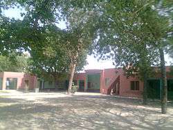
There is a government primary school[6] on the way to Chachohar.
See also
References
- ↑ "Move to set up museum in Mansa". The Tribune. 17 August 2002. Retrieved 15 June 2012.
- 1 2 "Compensate affected farmers, demands BKU". The Tribune. 17 August 2008. Retrieved 20 June 2012.
- ↑ "Lakhmir Wala". indiamapia.com. Retrieved 15 June 2012.
- ↑ Google Maps
- ↑ www.censusindia.gov.in
- ↑ Both pictures above, taken by Tari Buttar, is the proof itself