Chatuge Lake
| Lake Chatuge | |
|---|---|
 Fishermen on Lake Chatuge with Appalachian Mountains in background. | |
| Location | United States |
| Coordinates | 34°59′28″N 83°47′06″W / 34.991°N 83.785°WCoordinates: 34°59′28″N 83°47′06″W / 34.991°N 83.785°W |
| Surface area | 10.9 sq mi (28 km2) |
| Average depth | 9.1 m (30 ft) |
| Max. depth | 44 m (144 ft) at dam |
| Water volume | 740,089 m3 (26,136,000 cu ft) maximum |
| Settlements | Hayesville, Hiawassee, Macedonia |
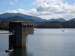
Lake Chatuge is a man-made reservoir created by the Chatuge Dam which finished construction in 1942.[1] The lake is relatively shallow with depths of 30 feet (9.1 m) and reaches 144 feet (44 m) by the dam. [2]
See also
References
- ↑ Chatuge Reservoir at TVA
- ↑ "Lake Chatuge Vacation Info - Lakelubbers". Lakelubbers. Retrieved 2017-05-28.
This article is issued from
Wikipedia.
The text is licensed under Creative Commons - Attribution - Sharealike.
Additional terms may apply for the media files.