Chatsworth, Queensland
| Chatsworth Gympie, Queensland | |||||||||||||||
|---|---|---|---|---|---|---|---|---|---|---|---|---|---|---|---|
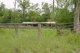 Horton Road cattle dip, 2002 | |||||||||||||||
| Population | 1,043 (2011 census)[1] | ||||||||||||||
| Postcode(s) | 4570 | ||||||||||||||
| Location | |||||||||||||||
| LGA(s) | Gympie Region | ||||||||||||||
| State electorate(s) | Gympie | ||||||||||||||
| Federal Division(s) | Wide Bay | ||||||||||||||
| |||||||||||||||
Chatsworth is a locality in the Gympie Region, Queensland, Australia.[2] At the 2011 census, Chatsworth and the surrounding area had a population of 1,043.[1]
Geography
Chatsworth is located about 7.5 kilometres (5 mi) north-northwest of Gympie, Queensland, Australia.
Historically, the suburb was mostly used for dairy farming, but is now predominantly used for residential land. The area was once part of the Shire of Cooloola a former local government area.
There is a small primary school servicing the district. Fishermans Pocket State Forest occupies a large section of the south west of Chatsworth.
References
- 1 2 Australian Bureau of Statistics (31 October 2012). "Chatsworth (Cooloola Shire) (State Suburb)". 2011 Census QuickStats. Retrieved 6 May 2015.

- ↑ "Chatsworth - locality in the Gympie region (entry 49680)". Queensland Place Names. Queensland Government. Retrieved 21 July 2017.
External links
Coordinates: 26°08′38″S 152°36′50″E / 26.144°S 152.614°E
This article is issued from
Wikipedia.
The text is licensed under Creative Commons - Attribution - Sharealike.
Additional terms may apply for the media files.