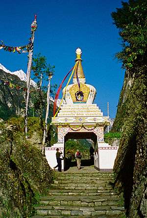
Chame, Nepal
| Chame चाँमे | |
|---|---|
| Municipality | |
 | |
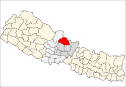
 Chame Location in Nepal | |
| Coordinates: 28°33′7″N 84°14′27″E / 28.55194°N 84.24083°ECoordinates: 28°33′7″N 84°14′27″E / 28.55194°N 84.24083°E | |
| Country |
|
| Zone | Gandaki Zone |
| District | Manang District |
| Elevation | 2,650 m (8,690 ft) |
| Population (2011)[1] | |
| • Total | 1,129 |
| Time zone | UTC+5:45 (Nepal Time) |
Chame (Nepali: चाँमे) is the headquarters of Manang District in the Gandaki Zone of northern Nepal.[2] At the time of the 2011 Nepal census it had a population of 1129 people living in 279 individual households. Manang District is the lowest populated district in Nepal.
2015 Nepal earthquake
The village was affected by an earthquake on 25 April 2015. Reports from the area indicate that the roads and buildings of the village are damaged.[3]
References
- ↑ "National Population and Housing Census 2011(Village Development Committee/Municipality)" (PDF). Government of Nepal. National Planning Commission. November 2012.
- ↑ Districts of Nepal - Statoids
- ↑ Amey, Ben (27 April 2015). "Delmar doctor stranded in Nepal after earthquake". WNYT.com. WNYT.com. Archived from the original on 1 May 2015. Retrieved 1 May 2015.
Headquarters: Chame Rural Municipality | ||
| Rural municipalities |
|  |
| Former VDCs | ||
This article is issued from
Wikipedia.
The text is licensed under Creative Commons - Attribution - Sharealike.
Additional terms may apply for the media files.