Chalonnes-sur-Loire
| Chalonnes-sur-Loire | ||
|---|---|---|
| Commune | ||
.jpg) The Chalonnes-sur-Loire bridge | ||
| ||
 Chalonnes-sur-Loire Location within Pays de la Loire region  Chalonnes-sur-Loire | ||
| Coordinates: 47°21′05″N 0°45′45″W / 47.3514°N 0.7625°WCoordinates: 47°21′05″N 0°45′45″W / 47.3514°N 0.7625°W | ||
| Country | France | |
| Region | Pays de la Loire | |
| Department | Maine-et-Loire | |
| Arrondissement | Angers | |
| Canton | Chalonnes-sur-Loire | |
| Government | ||
| • Mayor | Stella Dupont | |
| Area1 | 38.56 km2 (14.89 sq mi) | |
| Population (2012)2 | 6,550 | |
| • Density | 170/km2 (440/sq mi) | |
| Time zone | UTC+1 (CET) | |
| • Summer (DST) | UTC+2 (CEST) | |
| INSEE/Postal code | 49063 /49290 | |
| Elevation |
10–99 m (33–325 ft) (avg. 28 m or 92 ft) | |
|
1 French Land Register data, which excludes lakes, ponds, glaciers > 1 km2 (0.386 sq mi or 247 acres) and river estuaries. 2 Population without double counting: residents of multiple communes (e.g., students and military personnel) only counted once. | ||

Chalonnes-sur-Loire is a commune in the Maine-et-Loire department in western France. It is located on the right bank of the Loire River in the Loire Valley UNESCO World Heritage Site area.
Geography
The town is in the heart of the Anjou, a historical agricultural region southwest of Angers renowned for Loire Valley wines. The Layon flows into the Loire River at the commune.
The airport nearest to Chalonnes-sur-Loire for regional flights is Angers – Loire Airport (41 km), and for international flights is Nantes Atlantique Airport (67 km).[1]
Twin towns
Chalonnes-sur-Loire is twinned with:


See also
References
- ↑ "information" Archived 2011-10-05 at the Wayback Machine.
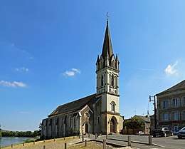
Saint-Maurille church of Chalonnes-sur-Loire
| Wikimedia Commons has media related to Chalonnes-sur-Loire. |
This article is issued from
Wikipedia.
The text is licensed under Creative Commons - Attribution - Sharealike.
Additional terms may apply for the media files.