Turquant
| Turquant | |
|---|---|
| Commune | |
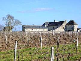 At the vineyard, on the edge of Parnay | |
 Turquant Location within Pays de la Loire region  Turquant | |
| Coordinates: 47°13′23″N 0°01′41″E / 47.223°N 0.028°ECoordinates: 47°13′23″N 0°01′41″E / 47.223°N 0.028°E | |
| Country | France |
| Region | Pays de la Loire |
| Department | Maine-et-Loire |
| Arrondissement | Saumur |
| Canton | Saumur |
| Intercommunality | CA Saumur Val de Loire |
| Government | |
| • Mayor | Jackie Goulet |
| Area1 | 7.86 km2 (3.03 sq mi) |
| Population (1999)2 | 448 |
| • Density | 57/km2 (150/sq mi) |
| Time zone | UTC+1 (CET) |
| • Summer (DST) | UTC+2 (CEST) |
| INSEE/Postal code | 49358 /49730 |
| Elevation |
26–103 m (85–338 ft) (avg. 42 m or 138 ft) |
|
1 French Land Register data, which excludes lakes, ponds, glaciers > 1 km2 (0.386 sq mi or 247 acres) and river estuaries. 2 Population without double counting: residents of multiple communes (e.g., students and military personnel) only counted once. | |
Turquant is a commune in the Maine-et-Loire department in western France.
See also
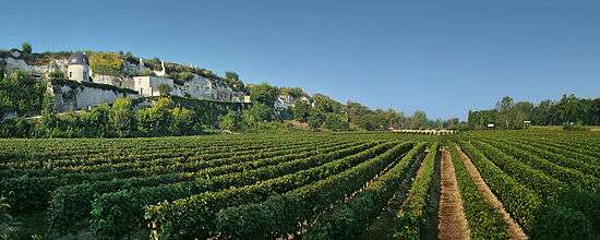
Vineyards and troglodytic houses along route D947
| Wikimedia Commons has media related to Turquant. |
This article is issued from
Wikipedia.
The text is licensed under Creative Commons - Attribution - Sharealike.
Additional terms may apply for the media files.