Ceglédbercel
| Ceglédbercel | ||
|---|---|---|
| ||
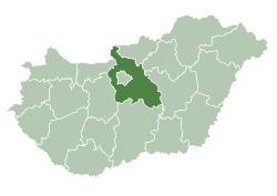
 Ceglédbercel Location of Ceglédbercel in Hungary | ||
| Coordinates: 47°13′21″N 19°39′59″E / 47.22248°N 19.66636°E | ||
| Country | Hungary | |
| Region | Central Hungary | |
| County | Pest | |
| Area[1] | ||
| • Total | 2.815 km2 (1.087 sq mi) | |
| Population (1 January 2009)[2] | ||
| • Total | 4,440 | |
| • Density | 1,600/km2 (4,100/sq mi) | |
| Time zone | UTC+1 (CET) | |
| • Summer (DST) | UTC+2 (CEST) | |
| Postal code | 2737 | |
| Area code | +36 53 | |
| KSH code | 20640[3] | |
| Website |
www | |

Ceglédbercel is a village in Pest County, Hungary.
References
- ↑ Ceglédbercel at the Hungarian Central Statistical Office (Hungarian).
- ↑ Ceglédbercel at the Hungarian Central Statistical Office (Hungarian). 1 January 2009
- ↑ Ceglédbercel at the Hungarian Central Statistical Office (Hungarian).

This article is issued from
Wikipedia.
The text is licensed under Creative Commons - Attribution - Sharealike.
Additional terms may apply for the media files.