Catawba Island State Park
| Catawba Island State Park | |
| Ohio State Park | |
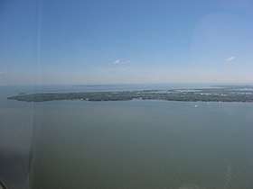 Catawba Island from the air, looking east | |
| Country | United States |
|---|---|
| State | Ohio |
| County | Ottawa |
| Elevation | 587 ft (179 m) [1] |
| Coordinates | 41°34′30″N 82°51′26″W / 41.57500°N 82.85722°WCoordinates: 41°34′30″N 82°51′26″W / 41.57500°N 82.85722°W [1] |
| Area | 10 acres (4 ha) [2] |
| Established | 1950s |
| Management | Ohio Department of Natural Resources |
 Location in Ohio | |
| Website: Catawba Island State Park | |
Catawba Island State Park is a ten-acre (4.0 ha) public recreation area offering access to Lake Erie, located at 4049 E. Moores Dock Road, Port Clinton, Ohio.[2] Boating, fishing and picnicking are the major activities of the park.[3] The state park was established in the early 1950s, along with the other units in Ohio's Lake Erie state parks group.[4]
References
- 1 2 "Catawba Island State Park". Geographic Names Information System. United States Geological Survey.
- 1 2 "Catawba Island State Park". Ohio Department of Natural Resources. Retrieved January 23, 2018.
- ↑ "Catawba Island State Park: Activities". Ohio Department of Natural Resources. Retrieved January 23, 2018.
- ↑ "Catawba Island State Park: History". Ohio Department of Natural Resources. Retrieved January 23, 2018.
External links
- Catawba Island State Park Ohio Department of Natural Resources
- Catawba Island State Park Map Ohio Department of Natural Resources
This article is issued from
Wikipedia.
The text is licensed under Creative Commons - Attribution - Sharealike.
Additional terms may apply for the media files.