Canton Township, Fulton County, Illinois
| Canton Township | |
|---|---|
| Township | |
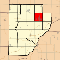 Location in Fulton County | |
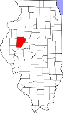 Fulton County's location in Illinois | |
| Coordinates: 40°34′54″N 90°02′47″W / 40.58167°N 90.04639°WCoordinates: 40°34′54″N 90°02′47″W / 40.58167°N 90.04639°W | |
| Country | United States |
| State | Illinois |
| County | Fulton |
| Established | November 6, 1849 |
| Area | |
| • Total | 35.64 sq mi (92.3 km2) |
| • Land | 34.74 sq mi (90.0 km2) |
| • Water | 0.9 sq mi (2 km2) 2.53% |
| Elevation | 676 ft (206 m) |
| Population (2010) | |
| • Estimate (2016)[1] | 15,049 |
| • Density | 452.1/sq mi (174.6/km2) |
| Time zone | UTC-6 (CST) |
| • Summer (DST) | UTC-5 (CDT) |
| ZIP codes | 61427, 61520, 61531 |
| FIPS code | 17-057-11020 |
Canton Township is one of twenty-six townships in Fulton County, Illinois, USA. As of the 2010 census, its population was 15,703 and it contained 6,376 housing units.[2]
Geography
According to the 2010 census, the township has a total area of 35.64 square miles (92.3 km2), of which 34.74 square miles (90.0 km2) (or 97.47%) is land and 0.9 square miles (2.3 km2) (or 2.53%) is water.[2]
Cities, towns, villages
Unincorporated towns
- Brereton
- East Lawndale
- Prospect Heights Addition
- Village Square
- Westview Acres
(This list is based on USGS data and may include former settlements.)
Cemeteries
The township contains these seven cemeteries: Greenwood, Hanson, Johnson, Norris, Saint Josephs, Saint Marys and White Chapel.
Major highways
Airports and landing strips
- Ingersoll Airport
Lakes
- Van Winkle Lake
Landmarks
- Big Creek Park
- Graham Hosp
Demographics
| Historical population | |||
|---|---|---|---|
| Census | Pop. | %± | |
| Est. 2016 | 15,049 | [1] | |
| U.S. Decennial Census[3] | |||
School districts
- Canton Union School District 66
Political districts
- Illinois' 17th congressional district
- State House District 91
- State Senate District 46
References
- "Canton Township, Fulton County, Illinois". Geographic Names Information System. United States Geological Survey. Retrieved 2010-01-16.
- United States Census Bureau 2007 TIGER/Line Shapefiles
- United States National Atlas
- 1 2 "Population and Housing Unit Estimates". Retrieved June 9, 2017.
- 1 2 "Population, Housing Units, Area, and Density: 2010 - County -- County Subdivision and Place -- 2010 Census Summary File 1". United States Census. Retrieved 2013-05-28.
- ↑ "Census of Population and Housing". Census.gov. Retrieved June 4, 2016.
External links
Places adjacent to Canton Township, Fulton County, Illinois | |
|---|---|
Municipalities and communities of Fulton County, Illinois, United States | ||
|---|---|---|
| Cities | ||
| Town | ||
| Villages | ||
| Townships | ||
| Unincorporated communities | ||
| Ghost towns | ||
| Footnotes | ‡This populated place also has portions in an adjacent county or counties | |
This article is issued from
Wikipedia.
The text is licensed under Creative Commons - Attribution - Sharealike.
Additional terms may apply for the media files.