Canning Parish, New Brunswick
| Canning | |
|---|---|
| Parish | |
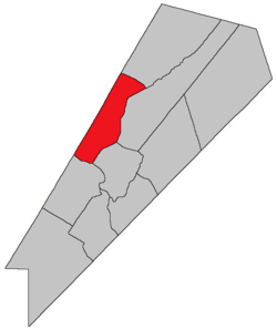 Location within Queens County, New Brunswick. | |
| Country |
|
| Province |
|
| County | Queens County |
| Established | 1765 |
| Area[1] | |
| • Land | 173.40 km2 (66.95 sq mi) |
| Population (2011)[1] | |
| • Total | 952 |
| • Density | 5.5/km2 (14/sq mi) |
| • Pop 2006–11 |
|
| • Dwellings | 836 |
| Time zone | UTC-4 (AST) |
| • Summer (DST) | UTC-3 (ADT) |
Canning is a Canadian parish in Queens County, New Brunswick.[2]
History
Canning Parish set off from Waterborough Parish in 1827: named for the Right Honourable George Canning, (1770–1827) who was prime minister of the United Kingdom: included part of Chipman Parish until 1835.
Delineation
is defined in the Territorial Division Act[3] as being bounded:
- Northeast by Chipman Parish; northwest by the County line; southwest by the Saint John River, and southeast by Cambridge and Waterborough Parishes.
Communities
Parish population total does not include incorporated municipalities (in bold).
- Back Road
- Canning
- Clarks Corners
- Douglas Harbour
- Flowers Cove
- Lake Road
- Maquapit Lake
- Newcastle Center
- Newcastle Centre
- Newcastle Creek
- Princess Park
- Scotchtown
- Sunnyside Beach
- Sypher Cove
- Upper Gagetown
- Wuhr's Beach Road
Bodies of water & Islands
Rivers, lakes, streams, creeks, marshes and Islands that are at least partially in this parish include:
- Grand Lake
- Maquapit Lake
- Pickerel Pond Nature Preserve
- Grand Lake Meadow
- Lower Timber Lake
- The Keyhole
Demographics
Access Routes
Highways and numbered routes that run through the parish, including external routes that start or finish at the parish limits:[6]
|
|
|
|
See also
References
- 1 2 2011 Statistics Canada Census Profile: Canning Parish, New Brunswick
- ↑ New Brunswick Provincial Archives - Canning Parish
- ↑ "Territorial Division Act (R.S.N.B. 1973, c. T-3)". Government of New Brunswick website. Retrieved 17 August 2016.
- ↑ Statistics Canada: 2001, 2006 census
- ↑ Profile: Canning Parish, New Brunswick
- ↑ Atlantic Canada Back Road Atlas ISBN 978-1-55368-618-7
Places adjacent to Canning Parish, New Brunswick | |
|---|---|
| Subdivisions | |
|---|---|
| Cities | |
| Counties | |
| |
This article is issued from
Wikipedia.
The text is licensed under Creative Commons - Attribution - Sharealike.
Additional terms may apply for the media files.