Campobello Parish, New Brunswick
| Campobello | |
|---|---|
| Parish | |
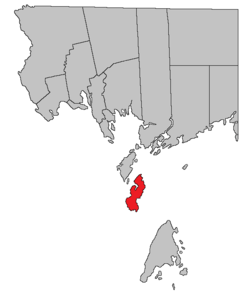 Location within Charlotte County. | |
| Country |
|
| Province |
|
| County | Charlotte County |
| Established | 1803 |
| Area[1] | |
| • Land | 39.67 km2 (15.32 sq mi) |
| Population (2011)[1] | |
| • Total | 925 |
| • Density | 23.3/km2 (60/sq mi) |
| • Pop 2006-2011 |
|
| • Dwellings | 632 |
| Time zone | UTC-4 (AST) |
| • Summer (DST) | UTC-3 (ADT) |
Campobello is a Canadian parish including one main island and several small islands and islets in Charlotte County, New Brunswick.[2]
History
Campobello Parish was established in 1803 from West Isles Parish. The entire parish was incorporated as the rural community of Campobello Island in 2010.
Delineation
Campobello Parish is defined in the Territorial Division Act[3] as:
"Being the island so named, and other islands to the south and east of Head Harbour Passage, but west of Grand Manan."
Communities
Parish population total does not include incorporated municipalities (in bold).
- North Road
- Otter Cove
- Welshpool
- Wilsons Beach
Bodies of water & Islands
This is a list of rivers, lakes, streams, creeks, marshes and Islands that are at least partially in this parish
|
|
|
|
Demographics
Population
| Canada census – Campobello Parish, New Brunswick community profile | |||
|---|---|---|---|
| 2011 | 2006 | ||
| Population: | 925 (-12.4% from 2006) | 1,056 (-11.6% from 2001) | |
| Land area: | 39.67 km2 (15.32 sq mi) | 39.59 km2 (15.29 sq mi) | |
| Population density: | 23.3/km2 (60/sq mi) | 26.7/km2 (69/sq mi) | |
| Median age: | 46.0 (M: 46.1, F: 45.9) | 43.4 (M: 43.3, F: 43.5) | |
| Total private dwellings: | 641 | 632 | |
| Median household income: | $.N/A | $38,159 | |
| Notes: 2011 income data for this area has been suppressed for data quality or confidentiality reasons. – References: 2011[4] 2006[5] earlier[6] | |||
| Historical Census Data - Campobello Parish, New Brunswick[7] | ||||||||||||||||||||||||||
|---|---|---|---|---|---|---|---|---|---|---|---|---|---|---|---|---|---|---|---|---|---|---|---|---|---|---|
|
|
| ||||||||||||||||||||||||
Language
| Canada Census Mother Tongue - Campobello Parish, New Brunswick[7] | ||||||||||||||||||
|---|---|---|---|---|---|---|---|---|---|---|---|---|---|---|---|---|---|---|
| Census | Total | English |
French |
English & French |
Other | |||||||||||||
| Year | Responses | Count | Trend | Pop % | Count | Trend | Pop % | Count | Trend | Pop % | Count | Trend | Pop % | |||||
2011 |
895 |
885 | 98.88% | 5 | 0.56% | 0 | 0.00% | 5 | 0.56% | |||||||||
2006 |
1,035 |
985 | 95.17% | 30 | 2.90% | 0 | 0.00% | 20 | 1.93% | |||||||||
2001 |
1,165 |
1,165 | 100.00% | 0 | 0.00% | 0 | 0.00% | 0 | 0.00% | |||||||||
1996 |
1,280 |
1,280 | n/a | 100.00% | 0 | n/a | 0.00% | 0 | n/a | 0.00% | 0 | n/a | 0.00% | |||||
Access Routes
Highways and numbered routes that run through the parish, including external routes that start or finish at the parish limits:[8]
|
|
|
|
See also
References
- 1 2 2011 Statistics Canada Census Profile: Campobello Parish, New Brunswick
- ↑ New Brunswick Provincial Archives - Campobello Parish
- ↑ "Territorial Division Act (R.S.N.B. 1973, c. T-3)". Government of New Brunswick website. Retrieved 17 August 2016.
- ↑ "2011 Community Profiles". Canada 2011 Census. Statistics Canada. July 5, 2013. Retrieved 2014-03-15.
- ↑ "2006 Community Profiles". Canada 2006 Census. Statistics Canada. March 30, 2011. Retrieved 2014-03-15.
- ↑ "2001 Community Profiles". Canada 2001 Census. Statistics Canada. February 17, 2012.
- 1 2 Statistics Canada: 1996, 2001, 2006, 2011 census
- ↑ Atlantic Canada Back Road Atlas ISBN 978-1-55368-618-7 Pages 4, 12
Places adjacent to Campobello Parish, New Brunswick | |
|---|---|
| Subdivisions | |
|---|---|
| Cities | |
| Counties | |
| |
Coordinates: 44°52′40″N 66°56′38″W / 44.877768°N 66.943817°W