Camopi
| Camopi | |
|---|---|
| Commune | |
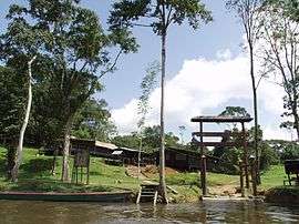 Entrance to the Camopi encampment of the 3rd Foreign Infantry Regiment | |
 Location of the commune (in red) within French Guiana | |
| Coordinates: 3°09′56″N 52°20′28″W / 3.1655°N 52.3411°WCoordinates: 3°09′56″N 52°20′28″W / 3.1655°N 52.3411°W | |
| Country | France |
| Overseas region and department | French Guiana |
| Arrondissement | Cayenne |
| Intercommunality | Est Guyanais |
| Government | |
| • Mayor (2014-2020) | René Monerville |
| Area1 | 10,030 km2 (3,870 sq mi) |
| Population (2012)2 | 1,665 |
| • Density | 0.17/km2 (0.43/sq mi) |
| INSEE/Postal code | 97356 /97330 |
|
1 French Land Register data, which excludes lakes, ponds, glaciers > 1 km2 (0.386 sq mi or 247 acres) and river estuaries. 2 Population without double counting: residents of multiple communes (e.g., students and military personnel) only counted once. | |
Camopi is a commune of French Guiana, an overseas region and department of France located in South America.
Geography
With a land area of 10,030 km2 (3,870 sq mi), it is the third-largest commune of France.
The village of Camopi, seat of the commune, lies on the border with Brazil at the confluence of the Camopi River into the Oyapock River.
It is served by Vila Brasil Airport.
See also
References
External links
| Wikimedia Commons has media related to Camopi. |
This article is issued from
Wikipedia.
The text is licensed under Creative Commons - Attribution - Sharealike.
Additional terms may apply for the media files.