California State Route 121
| ||||
|---|---|---|---|---|
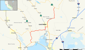 Map of western California with SR 121 highlighted in red | ||||
| Route information | ||||
| Defined by Streets and Highways Code § 421 | ||||
| Maintained by Caltrans | ||||
| Length | 33.57 mi[1] (54.02 km) | |||
| Major junctions | ||||
| South end |
| |||
| North end |
| |||
| Location | ||||
| Counties | Sonoma, Napa | |||
| Highway system | ||||
| ||||

State Route 121 (SR 121) is a California state highway in the Wine Country that runs northerly from its junction with State Route 37 at Sears Point, past the Tolay Lake basin and across Tolay Creek near Infineon Raceway, veers east at a junction with State Route 116 and Bonneau Road at Schellville, runs eastward through the Carneros region of the southern Sonoma Valley and Napa Valley (concurrent first with State Route 12, then with State Route 29), then northeastward to end near Lake Berryessa in Napa County.
Route description
The route begins at SR 37 in Sears Point. As it continues northward through Sonoma County, it meets SR 116. It then enters Schellville, where it begins a short overlap with SR 12. Upon leaving, it begins another overlap with SR 29, which happens to be a freeway, in Napa County. When it leaves, it continues northward and meets SR 221 in Napa. As it leaves the city, it continues northward for several miles before reaching its north end at SR 128.
SR 121 is part of the California Freeway and Expressway System,[2] but is not part of the National Highway System,[3] a network of highways that are considered essential to the country's economy, defense, and mobility by the Federal Highway Administration.[4] SR 121 is eligible to be included in the State Scenic Highway System,[5] but it is not officially designated as a scenic highway by the California Department of Transportation.[6] The California Legislature named the route Carneros Highway from its southern terminus to its junction with SR 29 in Napa, after the Carneros settlement.[7]
History
The section from SR 37 to SR 29 in Napa remains virtually unchanged since its definition in 1963. The northern section, however, was slightly altered since its definition the same year due to a realignment of various other freeways.[8]
Major intersections
Except where prefixed with a letter, postmiles were measured on the road as it was in 1964, based on the alignment that existed at the time, and do not necessarily reflect current mileage. R reflects a realignment in the route since then, M indicates a second realignment, L refers an overlap due to a correction or change, and T indicates postmiles classified as temporary (for a full list of prefixes, see the list of postmile definitions).[1] Segments that remain unconstructed or have been relinquished to local control may be omitted. The numbers reset at county lines; the start and end postmiles in each county are given in the county column.
| County | Location | Postmile [9][10] | Destinations | Notes | |
|---|---|---|---|---|---|
| Sonoma SON 0.00-11.62 | Sears Point | 0.00 | South end of SR 121 | ||
| | 6.69 | ||||
| Schellville | 7.44 | South end of SR 12 overlap | |||
| | R10.79 | Napa Road | |||
| Napa NAP 0.00-22.08 | Napa | R4.47 R8.66[N 1] | North end of SR 12 overlap; south end of SR 29 overlap | ||
| South end of freeway on SR 29 | |||||
| North end of freeway on SR 29 | |||||
| R10.30[N 1] R4.47 | Interchange; north end of SR 29 overlap | ||||
| 6.01 | |||||
| 6.55 | Soscol Avenue north – Downtown Napa | ||||
| | 9.40 | Silverado Trail, Trancas Street | |||
| | 16.07 | Wooden Valley Road – Fairfield | |||
| | 22.08 | North end of SR 121 | |||
1.000 mi = 1.609 km; 1.000 km = 0.621 mi
| |||||
See also

References
- 1 2 California Department of Transportation. "State Truck Route List". Sacramento: California Department of Transportation. Archived from the original (XLS file) on June 30, 2015. Retrieved June 30, 2015.
- ↑ California State Legislature. "Section 250–257". Streets and Highways Code. Sacramento: California State Legislature. Retrieved June 9, 2017.
- ↑ Federal Highway Administration (March 25, 2015). National Highway System: California (North) (PDF) (Map). Scale not given. Washington, DC: Federal Highway Administration.
- ↑ Natzke, Stefan; Neathery, Mike & Adderly, Kevin (June 20, 2012). "What is the National Highway System?". National Highway System. Washington, DC: Federal Highway Administration. Retrieved July 1, 2012.
- ↑ California State Legislature. "Section 260–284". Streets and Highways Code. Sacramento: California State Legislature. Retrieved June 9, 2017.
- ↑ California Department of Transportation (September 7, 2011). "Officially Designated State Scenic Highways and Historic Parkways". Sacramento: California Department of Transportation. Retrieved September 30, 2017.
- ↑ California Department of Transportation; California State Transportation Agency (January 2015). 2014 Named Freeways, Highways, Structures and Other Appurtenances in California. Sacramento: California Department of Transportation. pp. 76, 215. Archived from the original (PDF) on May 30, 2015. Retrieved May 30, 2015.
- ↑ Faigin, Daniel P. "California Highways:Routes 121 through 128". Retrieved 2010-04-27.
- ↑ California Department of Transportation (April 2008). "Log of Bridges on State Highways". Sacramento: California Department of Transportation.
- ↑ California Department of Transportation, All Traffic Volumes on CSHS, 2007
External links
Route map:
| Wikimedia Commons has media related to California State Route 121. |