California State Route 221
| ||||
|---|---|---|---|---|
| Napa-Vallejo Highway | ||||
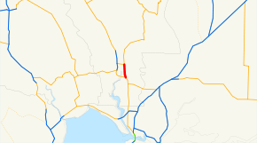 SR 221 highlighted in red | ||||
| Route information | ||||
| Defined by Streets and Highways Code § 521 | ||||
| Maintained by Caltrans | ||||
| Length | 2.682 mi[1] (4.316 km) | |||
| Major junctions | ||||
| South end |
| |||
| North end |
| |||
| Location | ||||
| Counties | Napa | |||
| Highway system | ||||
| ||||

State Route 221 (SR 221) is a state highway in Napa County of the U.S. state of California.
Route description
Route 221 is the northernmost part of the Napa-Vallejo Highway. It is a divided four-lane expressway that serves as an alternate to the nearby Route 29 freeway into Napa from the south. Unlike Route 29, however, 221 provides direct access to Napa Valley College and Napa State Hospital. The southern terminus is with Route 29 (which also carries Route 12), where it continues as the Napa-Vallejo Highway. The northern terminus is an intersection with Route 121, where 121 continues north as Soscol Avenue.
SR 221 is part of the National Highway System,[2] a network of highways that are considered essential to the country's economy, defense, and mobility by the Federal Highway Administration.[3]
Major intersections
Except where prefixed with a letter, postmiles were measured on the road as it was in 1964, based on the alignment that existed at the time, and do not necessarily reflect current mileage. R reflects a realignment in the route since then, M indicates a second realignment, L refers an overlap due to a correction or change, and T indicates postmiles classified as temporary (for a full list of prefixes, see the list of postmile definitions).[1] Segments that remain unconstructed or have been relinquished to local control may be omitted. The entire route is in Napa County.
| Location | Postmile [1][4][5] | Destinations | Notes | ||
|---|---|---|---|---|---|
| | 0.00 | Soscol Ferry Road | Continuation beyond SR 12 / SR 29 | ||
| | 0.00 | South end of SR 221 | |||
| Napa | 2.68 | North end of SR 221 | |||
| 1.000 mi = 1.609 km; 1.000 km = 0.621 mi | |||||
See also

References
- 1 2 3 California Department of Transportation. "State Truck Route List". Sacramento: California Department of Transportation. Archived from the original (XLS file) on June 30, 2015. Retrieved June 30, 2015.
- ↑ Federal Highway Administration (March 25, 2015). National Highway System: Napa, CA (PDF) (Map). Scale not given. Washington, DC: Federal Highway Administration. Retrieved September 9, 2017.
- ↑ Natzke, Stefan; Neathery, Mike & Adderly, Kevin (June 20, 2012). "What is the National Highway System?". National Highway System. Washington, DC: Federal Highway Administration. Retrieved July 1, 2012.
- ↑ California Department of Transportation (July 2007). "Log of Bridges on State Highways". Sacramento: California Department of Transportation.
- ↑ California Department of Transportation, All Traffic Volumes on CSHS, 2005 and 2006
External links
Route map:
| Wikimedia Commons has media related to California State Route 221. |