Calatrava, Negros Occidental
| Calatrava | |
|---|---|
| Municipality | |
| Municipality of Calatrava | |
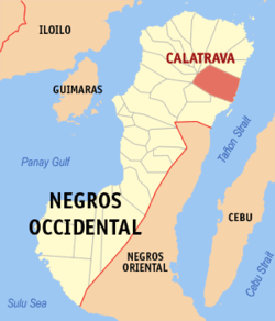 Map of Negros Occidental with Calatrava highlighted | |
.svg.png) Calatrava Location within the Philippines | |
| Coordinates: 10°36′N 123°29′E / 10.6°N 123.48°ECoordinates: 10°36′N 123°29′E / 10.6°N 123.48°E | |
| Country |
|
| Region | Western Visayas (Region VI) |
| Province | Negros Occidental |
| District | 1st district of Negros Occidental |
| Barangays | 40 (see Barangays) |
| Government [1] | |
| • Type | Sangguniang Bayan |
| • Mayor | Araceli T. Somosa |
| • Electorate | 46,519 voters (2016) |
| Area [2] | |
| • Total | 504.50 km2 (194.79 sq mi) |
| Population (2015 census)[3] | |
| • Total | 80,624 |
| • Density | 160/km2 (410/sq mi) |
| Time zone | UTC+8 (PST) |
| ZIP code | 6126 |
| PSGC | 064505000 |
| IDD : area code | +63 (0)34 |
| Climate type | Tropical climate |
| Income class | 1st municipal income class |
| Revenue (₱) | 206,742,187.80 (2016) |
| Native languages |
Hiligaynon Tagalog |
Calatrava, officially the Municipality of Calatrava, is a 1st class municipality in the province of Negros Occidental, Philippines. According to the 2015 census, it has a population of 80,624 people.[3]
Barangays
Calatrava is politically subdivided into 40 barangays.
- Agpangi
- Ani-e
- Bagacay
- Bantayanon
- Buenavista
- Cabungahan
- Calampisawan
- Cambayobo
- Castellano
- Cruz
- Dolis
- Hilub-Ang
- Hinab-Ongan
- Ilaya
- Laga-an
- Lalong
- Lemery
- Lipat-on
- Lo-ok (Poblacion)
- Ma-aslob
- Macasilao
- Malanog
- Malatas
- Marcelo
- Mina-utok
- Menchaca
- Minapasuk
- Mahilum
- Paghumayan
- Pantao
- Patun-an
- Pinocutan
- Refugio
- San Benito
- San Isidro
- Suba (Poblacion)
- Telim
- Tigbao
- Tigbon
- Winaswasan
Demographics
| Population census of Calatrava | ||
|---|---|---|
| Year | Pop. | ±% p.a. |
| 1903 | 6,385 | — |
| 1939 | 38,695 | +5.13% |
| 1948 | 53,805 | +3.73% |
| 1960 | 65,888 | +1.70% |
| 1970 | 53,151 | −2.12% |
| 1975 | 58,867 | +2.07% |
| 1980 | 58,163 | −0.24% |
| 1990 | 60,228 | +0.35% |
| 1995 | 69,902 | +2.83% |
| 2000 | 74,623 | +1.41% |
| 2007 | 78,452 | +0.69% |
| 2010 | 79,009 | +0.26% |
| 2015 | 80,624 | +0.39% |
| Source: Philippine Statistics Authority[3] [4] [5] [6] | ||
The people in the city speak the Cebuano language (often called Bisaya). Filipino and English are generally understood especially in the urban areas.
References
- ↑ "Municipality". Quezon City, Philippines: Department of the Interior and Local Government. Retrieved 31 May 2013.
- ↑ "Province:". PSGC Interactive. Quezon City, Philippines: Philippine Statistics Authority. Retrieved 12 November 2016.
- 1 2 3 Census of Population (2015). "Region VI (Western Visayas)". Total Population by Province, City, Municipality and Barangay. PSA. Retrieved 20 June 2016.
- ↑ Census of Population and Housing (2010). "Region VI (Western Visayas)". Total Population by Province, City, Municipality and Barangay. NSO. Retrieved 29 June 2016.
- ↑ Censuses of Population (1903–2007). "Region VI (Western Visayas)". Table 1. Population Enumerated in Various Censuses by Province/Highly Urbanized City: 1903 to 2007. NSO.
- ↑ "Province of". Municipality Population Data. Local Water Utilities Administration Research Division. Retrieved 17 December 2016.
External links
- Philippine Standard Geographic Code
- Philippine census information
- Local Governance Performance Management System
Places adjacent to Calatrava, Negros Occidental | |
|---|---|
Bacolod (capital) | |
| Municipalities | |
| Component cities | |
| Highly urbanized city |
|
This article is issued from
Wikipedia.
The text is licensed under Creative Commons - Attribution - Sharealike.
Additional terms may apply for the media files.