Salvador Benedicto
| Salvador Benedicto | ||
|---|---|---|
| Municipality | ||
| Municipality of Salvador Benedicto | ||
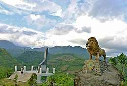 Salvador Benedicto Lion's Park | ||
| ||
| Nickname(s): Summer Capital of Negros Occidental | ||
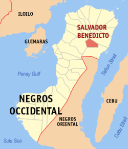 Map of Negros Occidental with Salvador Benedicto highlighted | ||
.svg.png) Salvador Benedicto Location within the Philippines | ||
| Coordinates: 10°33′02″N 123°14′11″E / 10.55056°N 123.23639°ECoordinates: 10°33′02″N 123°14′11″E / 10.55056°N 123.23639°E | ||
| Country |
| |
| Region | Western Visayas (Region VI) | |
| Province | Negros Occidental | |
| District | 1st district of Negros Occidental | |
| Founded | February 9, 1983 | |
| Barangays | 7 (see Barangays) | |
| Government [1] | ||
| • Type | Sangguniang Bayan | |
| • Mayor | Laurence Marxlen dela Cruz | |
| • Vice Mayor | Nehemiah Joe dela Cruz, Jr. | |
| • Electorate | 14,277 voters (2016) | |
| Area [2] | ||
| • Total | 170.50 km2 (65.83 sq mi) | |
| Population (2015 census)[3] | ||
| • Total | 25,662 | |
| • Density | 150/km2 (390/sq mi) | |
| Time zone | UTC+8 (PST) | |
| ZIP code | 6117 | |
| PSGC | 064532000 | |
| IDD : area code | +63 (0)34 | |
| Climate type | Tropical climate | |
| Income class | 4th municipal income class | |
| Revenue (₱) | 78,960,238.16 (2016) | |
| Native languages |
Hiligaynon Tagalog | |
| Website |
elgu | |

Salvador Benedicto, officially the Municipality of Salvador Benedicto and also known as Don Salvador Benedicto, is a 4th class municipality in the province of Negros Occidental, Philippines. According to the 2015 census, it has a population of 25,662 people.[3]
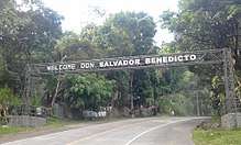
The municipality is a post-colonial provincial hill station and designated as the Summer Capital of Negros Occidental, a very popular tourist site amongst locals and foreigners seeking a moment of serenity away from the hustle-bustle of huge cities.[4]
History
Located at the center of the mountains of northern Negros Occidental, Don Salvador Benedicto was chartered through Batas Pambansa Bilang 336 by then President Ferdinand Marcos. It consolidated all the remote barangays of San Carlos City and the towns of Calatrava and Murcia which were apparently neglected due to inaccessibility. The town is named after the former Vice Governor Salvador V. Benedicto (March 31, 1889–November 28, 1956) who played an important role in the setting up of a Revolutionary Government in Negros Island particularly in Barangay Igmaya-an, when the country was occupied by the Japanese during World War II. Salvador Benedicto is a relative of Roberto Benedicto, President Marcos' crony.
Barangays
Salvador Benedicto is politically subdivided into 7 barangays.
- Bago (Lalung)
- Bagong Silang (Marcelo)
- Bunga
- Igmaya-an
- Kumaliskis
- Pandanon
- Pinowayan (Prosperidad)
Economy
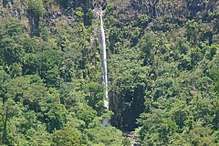
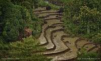
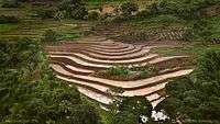
Although a small town, the town of Don Salvador Benedicto has seen a rise in its municipal economy thanks to tourism and local agriculture. Due to its high altitude like Baguio City, the town can support crops that grow in temperate areas, making it ideal for a multitude of farming businesses. Tourism is on the rise for the town especially when travellers head out into the heart of the province. Also located in the municipality are the Choco Hills, similar to Bohol's Chocolate Hills.[5]
Demographics
| Population census of Salvador Benedicto | ||
|---|---|---|
| Year | Pop. | ±% p.a. |
| 1990 | 13,538 | — |
| 1995 | 17,635 | +5.08% |
| 2000 | 17,259 | −0.46% |
| 2007 | 22,979 | +4.03% |
| 2010 | 23,624 | +1.01% |
| 2015 | 25,662 | +1.59% |
| Source: Philippine Statistics Authority[3][6][7][8] | ||
Major languages are Hiligaynon, followed by Cebuano with English and Filipino being used as second languages.
See also
References
- ↑ "Municipality". Quezon City, Philippines: Department of the Interior and Local Government. Retrieved 31 May 2013.
- ↑ "Province:". PSGC Interactive. Quezon City, Philippines: Philippine Statistics Authority. Retrieved 12 November 2016.
- 1 2 3 Census of Population (2015). "Region VI (Western Visayas)". Total Population by Province, City, Municipality and Barangay. PSA. Retrieved 20 June 2016.
- ↑ "Things to see and do in Don Salvador Benedicto, Negros Occidental". Yap, Roxie. Retrieved August 24, 2008.
- ↑ "Agriculture and Tourism Potentials of Don Salvador Benedicto". Reyes, Glady. Retrieved February 11, 2010.
- ↑ Census of Population and Housing (2010). "Region VI (Western Visayas)". Total Population by Province, City, Municipality and Barangay. NSO. Retrieved 29 June 2016.
- ↑ Censuses of Population (1903–2007). "Region VI (Western Visayas)". Table 1. Population Enumerated in Various Censuses by Province/Highly Urbanized City: 1903 to 2007. NSO.
- ↑ "Province of". Municipality Population Data. Local Water Utilities Administration Research Division. Retrieved 17 December 2016.
External links
- Don Salvador Benedicto Profile at the Official Website of Negros Occidental
- Philippine Standard Geographic Code
- Philippine Census Information
Places adjacent to Salvador Benedicto | ||||||||||
|---|---|---|---|---|---|---|---|---|---|---|
| ||||||||||
Bacolod (capital) | |
| Municipalities | |
| Component cities | |
| Highly urbanized city |
|