San Enrique, Negros Occidental
| San Enrique | |
|---|---|
| Municipality | |
| Municipality of San Enrique | |
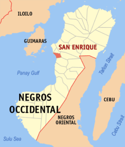 Map of Negros Occidental with San Enrique highlighted | |
.svg.png) San Enrique Location within the Philippines | |
| Coordinates: 10°25′N 122°51′E / 10.42°N 122.85°ECoordinates: 10°25′N 122°51′E / 10.42°N 122.85°E | |
| Country |
|
| Region | Western Visayas (Region VI) |
| Province | Negros Occidental |
| District | 4th district of Negros Occidental |
| Barangays | 10 (see Barangays) |
| Government [1] | |
| • Type | Sangguniang Bayan |
| • Mayor | Jilson Tubillara |
| • Vice Mayor | Roy de los Santos |
| • Electorate | 16,417 voters (2016) |
| Area [2] | |
| • Total | 28.84 km2 (11.14 sq mi) |
| Population (2015 census)[3] | |
| • Total | 23,907 |
| • Density | 830/km2 (2,100/sq mi) |
| Time zone | UTC+8 (PST) |
| ZIP code | 6104 |
| PSGC | 064525000 |
| IDD : area code | +63 (0)34 |
| Climate type | Tropical climate |
| Income class | 4th municipal income class |
| Revenue (₱) | 63,090,306.81 (2016) |
| Native languages |
Hiligaynon Tagalog |
San Enrique, officially the Municipality of San Enrique, is a 4th class municipality in the province of Negros Occidental, Philippines. According to the 2015 census, it has a population of 23,907 people.[3]
The town is notable for its signature delicacy buko pie.
Barangays
San Enrique is politically subdivided into 10 barangays.
- Bagonawa
- Baliwagan
- Batuan
- Guintorilan
- Nayon
- Poblacion
- Sibucao
- Tabao Baybay
- Tabao Rizal
- Tibsoc
Demographics
| Population census of San Enrique | ||
|---|---|---|
| Year | Pop. | ±% p.a. |
| 1903 | 6,095 | — |
| 1939 | 7,487 | +0.57% |
| 1948 | 8,117 | +0.90% |
| 1960 | 10,476 | +2.15% |
| 1970 | 12,368 | +1.67% |
| 1975 | 14,055 | +2.60% |
| 1980 | 14,662 | +0.85% |
| 1990 | 19,255 | +2.76% |
| 1995 | 20,649 | +1.32% |
| 2000 | 22,091 | +1.46% |
| 2007 | 22,987 | +0.55% |
| 2010 | 23,189 | +0.32% |
| 2015 | 23,907 | +0.58% |
| Source: Philippine Statistics Authority[3][4][5][6] | ||
References
- ↑ "Municipality". Quezon City, Philippines: Department of the Interior and Local Government. Retrieved 31 May 2013.
- ↑ "Province:". PSGC Interactive. Quezon City, Philippines: Philippine Statistics Authority. Retrieved 12 November 2016.
- 1 2 3 Census of Population (2015). "Region VI (Western Visayas)". Total Population by Province, City, Municipality and Barangay. PSA. Retrieved 20 June 2016.
- ↑ Census of Population and Housing (2010). "Region VI (Western Visayas)". Total Population by Province, City, Municipality and Barangay. NSO. Retrieved 29 June 2016.
- ↑ Censuses of Population (1903–2007). "Region VI (Western Visayas)". Table 1. Population Enumerated in Various Censuses by Province/Highly Urbanized City: 1903 to 2007. NSO.
- ↑ "Province of". Municipality Population Data. Local Water Utilities Administration Research Division. Retrieved 17 December 2016.
External links
- Philippine Standard Geographic Code
- Philippine Census Information
- Local Governance Performance Management System
Places adjacent to San Enrique, Negros Occidental | ||||||||||
|---|---|---|---|---|---|---|---|---|---|---|
| ||||||||||
Bacolod (capital) | |
| Municipalities | |
| Component cities | |
| Highly urbanized city |
|
This article is issued from
Wikipedia.
The text is licensed under Creative Commons - Attribution - Sharealike.
Additional terms may apply for the media files.