Cairnsmore of Fleet
| Cairnsmore of Fleet | |
|---|---|
 Cairnsmore of Fleet from the west | |
| Highest point | |
| Elevation | 711 m (2,333 ft) |
| Prominence | 522 m (1,713 ft) |
| Listing | Marilyn, Donald, Graham |
| Coordinates | 54°58′32″N 4°20′30″W / 54.97556°N 4.34167°W |
| Naming | |
| Translation | Great Cairn of Fleet (Scottish Gaelic + English) |
| Geography | |
| Location | Dumfries and Galloway, Scotland |
| Parent range | Southern Uplands |
| OS grid | NX501670 |
| Topo map | OS Landranger 83 |
Cairnsmore of Fleet is a mountain in the Scottish Lowlands, on the edges of Galloway Forest Park. It is home to the most extensive area of open moorland in Galloway, and has been designated as a Site of Special Scientific Interest (SSSI). To the eastern side of the hill, an area of 1,922 hectares is designated as a National Nature Reserve and is managed by Scottish Natural Heritage (SNH).[1]
Cairnsmore of Fleet National Nature Reserve
Cairnsmore of Fleet National Nature Reserve extends from the visitor centre below the Clints of Dromore, to Craignelder in the north and from the Knee of Cairnsmore in the west, to Little Mulltaggart in the east. The total land area within the NNR is 1,922 ha. Scottish Natural Heritage’s (SNH) predecessor, the Nature Conservancy Council, purchased 1,314 ha of land from the Forestry Commission in 1974 and declared the NNR in 1975. A further 608 ha are subject to Nature Reserve Agreements with neighbouring landowners, which include the summit of Cairnsmore of Fleet.
The site was chosen as representative of the granite uplands of Galloway and has continuity between un-afforested moorland and montane ground above the potential tree limit. The habitats present at Cairnsmore of Fleet were formerly widespread in the Southern Uplands, but have been much reduced over the past 60 years by land use changes from predominately hill farming and sporting interests to a greater proportion of forestry and recreational use.[1]
The NNR lies within the Galloway and Southern Ayrshire Biosphere. The Biosphere designation is awarded by The United Nations Educational, Scientific and Cultural Organisation (UNESCO) to areas renowned for their special environments which are valued by local people. The biosphere, one of over 650 around the world, covers over 5,000 square kilometres and is home to 95,000 people.
Topography
Cairnsmore of Fleet is an unafforested granite massif, whose highest point is about 10 km (6 mi) east of Newton Stewart in the south of Dumfries and Galloway (formerly Kirkcudbrightshire). It is the highest of the "Solway Hills", and overlooks the Cree Estuary and Wigtown Bay with views as far as the Lake District, Isle of Man and Snowdonia .[2]
Walking
The usual route of ascent is the "Tourist Route", which is one of the most popular hikes in Galloway .[3] It starts in the south-west, near Stronord, before climbing through the Bardrochwood Moor forest on to the summit. The Cairnsmore estate, near the start of this path, is the location mentioned in John Buchan's 1915 thriller The Thirty-nine Steps .[4] Other routes reach the summit from the south, over the Knee of Cairnsmore, and from the north, over Meikle Mulltaggart .[3]
Climbing
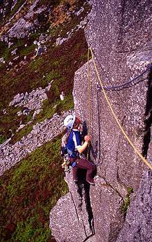
There are a number of good rock climbing areas on the subsidiary peaks around Cairnsmore of Fleet, but many of these have nesting birds on them so should be completely avoided in spring and early summer. The climbing is all on good quality granite. Areas that are described in the current guidebook [5] include Craignelder, Loch Grannoch and the Clints of Dromore.[6]
Ecology
Cairnsmore of Fleet is home to many of the typical habitats of upland Britain, such as grasslands of purple moor grass (Molinia caerulea), Calluna vulgaris and Vaccinium myrtillus heaths and localised blanket mire with Trichophorum and cotton-grass (Eriophorum). The summit region is characterised by sheep's fescue (Festuca ovina), bilberry, Carex bigelowii and the moss Racomitrium lanuginosum .[7] It one of the nine biosphere reserves in the United Kingdom ,[8] having been designated in 1976 .[7] The original area of 1,922 ha was increased to 3,559 ha when the Cairnsmore of Fleet reserve was merged with the Merrick Kells and Silver Flowe nature reserve .[9] The massif is also home to a variety of birds, mammals and invertebrates, including upland raptors such as the golden eagle, merlin, hen harrier and peregrine falcon, as well as a population of feral goats .[9][10]
Red and black grouse are managed on the estates, and there is extensive grazing by domestic sheep (chiefly Scottish Blackface) and cattle, which helps maintain habitats for birds. This has been hampered by the decline in farming of traditional breeds, such as Belted Galloway cattle, with farmers keeping breeds more suited to lowland grazing .[7]
Cairnsmore of Fleet is owned and managed by Scottish Natural Heritage .[10]
References
- 1 2 http://www.snh.gov.uk/docs/A1884737.pdf
- ↑ "Cairnsmore of Fleet". Galloway Mountain Rescue Team. 2006. Retrieved 2007-04-26.
- 1 2 "Routes onto Cairnsmore of Fleet". South West Scotland Hillwalking. Retrieved 2007-04-26.
- ↑ "Visitor attractions". Glenquicken Farm. Retrieved 2007-04-26.
- ↑ G. Nicoll & T. Prentice (2004). Lowland Outcrops (Scottish Mountaineering Club climbers' guide). Scottish Mountaineering Trust. pp. 376 pp. ISBN 0-907521-43-6.
- ↑ John Biggar. "Climbing in Galloway". Retrieved 2007-06-15.
- 1 2 3 "Biosphere Reserve Information: Cairnsmore of Fleet". UNESCO. Retrieved 2007-04-26.
- ↑ "UK Biosphere Reserves". DEFRA. 2005-09-14. Retrieved 2007-04-26.
- 1 2 "Cairnsmore of Fleet / Merrick Kells / Silver Flowe". DEFRA. 2002-01-04. Retrieved 2007-04-26.
- 1 2 "Cairnsmore of Fleet". Scottish Natural Heritage. 2005. Retrieved 2007-04-26.
External links
- Cairnsmore of Fleet is at coordinates 54°58′31″N 4°20′30″W / 54.975413°N 4.341573°WCoordinates: 54°58′31″N 4°20′30″W / 54.975413°N 4.341573°W