Cái Răng District
| Cái Răng District Quận Cái Răng | |
|---|---|
| Urban district | |
| Country |
|
| Province | Cần Thơ |
| Area | |
| • Total | 24 sq mi (63 km2) |
| Population (2007) | |
| • Total | 82,152 |
| • Density | 3,400/sq mi (1,313/km2) |
| Time zone | UTC+7 (UTC + 7) |
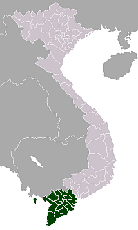
Cái Răng is an urban district of Cần Thơ in the Mekong Delta region of Vietnam. As of 2003 the district had a population of 77,292.[1] This increased to 82,152 in 2007. The district covers an area of 63 km².[1] Cái Răng District was established by Decree No. 05/2004/ND-CP on January 2, 2004. The district borders Vĩnh Long to the east, and also Tay Phong Điền District, Hậu Giang Province, and Bac Ninh Kieu District.
Cần Thơ is expanding southward and Cái Răng includes much of south Cần Thơ so it is growing in population and construction.
Administrative divisions
Cái Răng District is divided into wards (Phường):
- Lê Bình: 246,37 ha, 13,968 people
- Thường Thạnh: 1.035,81 ha, 10,431 people
- Phú Thứ: 2.013,29 ha, 12,781 people
- Tân Phú: 806,66 ha, 6,386 people
- Ba Láng: 531,52 ha, 6,339 people
- Hưng Phú
- Hưng Thạnh
References
- 1 2 "Districts of Vietnam". Statoids. Retrieved March 13, 2009.
Districts of the Mekong River Delta | ||
|---|---|---|
| Cần Thơ city |
|  |
| An Giang Province | ||
| Bạc Liêu Province | ||
| Bến Tre Province | ||
| Cà Mau Province | ||
| Đồng Tháp Province | ||
| Hậu Giang Province |
| |
| Kiên Giang Province | ||
| Long An Province | ||
| Sóc Trăng Province | ||
| Tiền Giang Province |
| |
| Trà Vinh Province | ||
| Vĩnh Long Province | ||
※ denotes provincial seat. | ||
Coordinates: 9°59′57″N 105°46′56″E / 9.99917°N 105.78222°E
This article is issued from
Wikipedia.
The text is licensed under Creative Commons - Attribution - Sharealike.
Additional terms may apply for the media files.