Cai Lậy District
| Cai Lậy District Huyện Cai Lậy | |
|---|---|
| Rural district | |
| Country |
|
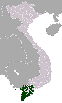
| Region | Mekong Delta |
| Province | Tien Giang |
| Capital | Cai Lậy |
| Area | |
| • Total | 159 sq mi (411 km2) |
| Population (2003) | |
| • Total | 320,220 |
| Time zone | UTC+7 (UTC + 7) |
Cai Lậy is a Rural district of Tien Giang province in the Mekong Delta region of Vietnam. As of 2003 the district had a population of 320,220.[1] The district covers an area of 411 km². The district capital lies at Cai Lậy.[1] The town of Cai Lậy split from the district in 2013.

A float market in river, Cai Lay district.
The town lies on Highway 1A, which links Ho Chi Minh City with the Mekong delta, and is near a continuous ribbon of commercial development. The hinterland is largely agricultural, with many small holdings specialising in growing a variety of fruits, including custard apples, [sweet mango] and pomelos in the fertile delta soils.
References
- 1 2 "Districts of Vietnam". Statoids. Retrieved March 13, 2009.
Coordinates: 10°25′01″N 106°04′59″E / 10.417°N 106.083°E
Districts of the Mekong River Delta | ||
|---|---|---|
| Cần Thơ city |
|  |
| An Giang Province | ||
| Bạc Liêu Province | ||
| Bến Tre Province | ||
| Cà Mau Province | ||
| Đồng Tháp Province | ||
| Hậu Giang Province |
| |
| Kiên Giang Province | ||
| Long An Province | ||
| Sóc Trăng Province | ||
| Tiền Giang Province |
| |
| Trà Vinh Province | ||
| Vĩnh Long Province | ||
※ denotes provincial seat. | ||
This article is issued from
Wikipedia.
The text is licensed under Creative Commons - Attribution - Sharealike.
Additional terms may apply for the media files.