Cabo da Ribeira
| Cabo da Ribeira | |
|---|---|
 The valley of Ribeira do Paul near Cabo da Ribeira | |
 | |
| Coordinates: 17°07′11″N 25°03′07″W / 17.1196°N 25.0519°WCoordinates: 17°07′11″N 25°03′07″W / 17.1196°N 25.0519°W | |
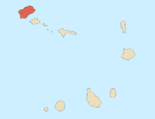
| Country | Cape Verde |
| Island | Santo Antão |
| Municipality | Paul |
| Civil parish | Santo António das Pombas |
| Population (2010)[1] | |
| • Total | 912 |
Cabo da Ribeira is a settlement in the eastern part of the island of Santo Antão, Cape Verde. In 2010 its population was 912. It is situated at about 500 m elevation in the upper valley of the Ribeira do Paul, 5 km southwest of Pombas. It is part of the municipality of Paul, and lies in the Cova-Paul-Ribeira da Torre Natural Park.
See also
References
- ↑ "2010 Census results". Instituto Nacional de Estatística Cabo Verde (in Portuguese). 24 November 2016.
Subdivisions of the island of Santo Antão | |||||||||
|---|---|---|---|---|---|---|---|---|---|
| Paul |
|  | |||||||
| Porto Novo |
| ||||||||
| Ribeira Grande |
| ||||||||
This article is issued from
Wikipedia.
The text is licensed under Creative Commons - Attribution - Sharealike.
Additional terms may apply for the media files.