Chã de Pedras
| Chã de Pedras | |
|---|---|
 | |
| Coordinates: 17°07′28″N 25°06′47″W / 17.1244°N 25.1131°WCoordinates: 17°07′28″N 25°06′47″W / 17.1244°N 25.1131°W | |
| Country | Cape Verde |
| Island | Santo Antão |
| Municipality | Ribeira Grande |
| Civil parish | Santo Crucifixo |
| Population (2010)[1] | |
| • Total | 1,266 |
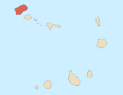
Chã de Pedras[2] is a settlement in the northcentral part of the island of Santo Antão, Cape Verde. In 2010 its population was 1,266. It is situated about 5 km south of Coculi, 8 km southeast of the city Ribeira Grande and 12 km northwest of the island capital Porto Novo. It consists of 21 localities in the valley of the Ribeira de Chã de Pedras, a right tributary of the Ribeira Grande. The elevation of the largest village, Pia de Cima, is about 430 metres.
See also
References
- ↑ "2010 Census results". Instituto Nacional de Estatística Cabo Verde (in Portuguese). 24 November 2016.
- ↑ Código Geográfico Nacional, Instituto Nacional de Estatística, code 11305, p. 6
Subdivisions of the island of Santo Antão | |||||||||
|---|---|---|---|---|---|---|---|---|---|
| Paul |
|  | |||||||
| Porto Novo |
| ||||||||
| Ribeira Grande |
| ||||||||
This article is issued from
Wikipedia.
The text is licensed under Creative Commons - Attribution - Sharealike.
Additional terms may apply for the media files.