Bukoba Airport
| Bukoba Airport Uwanja wa Ndege wa Bukoba (Swahili) | |||||||||||
|---|---|---|---|---|---|---|---|---|---|---|---|
 | |||||||||||
| Summary | |||||||||||
| Airport type | Public | ||||||||||
| Owner | Government of Tanzania | ||||||||||
| Operator | Tanzania Airports Authority | ||||||||||
| Location | Bukoba, Tanzania | ||||||||||
| Elevation AMSL | 3,766 ft / 1,148 m | ||||||||||
| Coordinates | 1°19′50″S 31°49′10″E / 1.33056°S 31.81944°ECoordinates: 1°19′50″S 31°49′10″E / 1.33056°S 31.81944°E | ||||||||||
| Website |
www | ||||||||||
| Map | |||||||||||
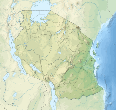 BKZ Location of Bukoba airport. | |||||||||||
| Runways | |||||||||||
| |||||||||||
| Statistics (2013) | |||||||||||
| |||||||||||
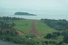
Bukoba Airport (IATA: BKZ, ICAO: HTBU) is an airport in northwestern Tanzania serving the town of Bukoba and the surrounding Kagera Region. It is adjacent to Lake Victoria.
The Bukoba non-directional beacon (Ident: BK) is located on the field.[6][7]
Airlines and destinations
| Airlines | Destinations |
|---|---|
| Auric Air | Rubondo, Mwanza |
| Precision Air | Mwanza |
| Air Tanzania | Mwanza |
See also


- List of airports in Tanzania
- Transport in Tanzania
References
- ↑ Mulisa, Meddy (4 January 2014). "Bukoba residents to be compensated". Daily News (Tanzania). Archived from the original on 4 January 2014. Retrieved 4 January 2014.
- ↑ "Consolidated Traffic Statistics". Tanzania Airports Authority. Archived from the original (PDF) on 24 September 2014. Retrieved 21 September 2014.
- ↑ "List of Aerodromes in Tanzania" (PDF). Tanzania Civil Aviation Authority. Retrieved 5 April 2013.
- ↑ Google Maps - Bukoba
- ↑ Airport information for BKZ at Great Circle Mapper.
- ↑ "Bukoba NDB (BK) @ OurAirports". ourairports.com. Retrieved 2018-08-28.
- ↑ "SkyVector: Flight Planning / Aeronautical Charts". skyvector.com. Retrieved 2018-08-28.
External links
- OpenStreetMap - Bukoba
- OurAirports - Bukoba
- Accident history for BKZ at Aviation Safety Network
- Bukoba Airport on YouTube
This article is issued from
Wikipedia.
The text is licensed under Creative Commons - Attribution - Sharealike.
Additional terms may apply for the media files.