Liard Highway
| |||||||||
|---|---|---|---|---|---|---|---|---|---|
|
British Columbia Highway 77 Northwest Territories Highway 7 | |||||||||
| Route information | |||||||||
| Length | 393 km (244 mi) | ||||||||
| Existed | 1984 – present | ||||||||
| British Columbia Highway 77 | |||||||||
| Length | 138 km[1] (86 mi) | ||||||||
| South end |
| ||||||||
| North end | BC-NWT border | ||||||||
| Northwest Territories Highway 7 | |||||||||
| Length | 255 km[2] (158 mi) | ||||||||
| South end | BC-NWT border | ||||||||
| North end |
| ||||||||
| Highway system | |||||||||
|
British Columbia provincial highways Northwest Territories highways
| |||||||||

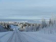
The Liard Highway, designated Highway 77 in British Columbia and Highway 7 in the Northwest Territories, is a highway in Canada which forms the sole road connection between B.C. and the Northwest Territories.
The highway officially opened to traffic in 1984 and was assigned the number 77 in 1986. It begins at a point on the Alaska Highway 28 km (17 mi) northwest of Fort Nelson and runs 138 km (86 mi) northeast through expanses of forest to the border of British Columbia and the Northwest Territories, beyond which it continues for 254 km (158 mi) as a very rough packed dirt and gravel road, designated Highway 7. It terminates at a junction with Highway 1 south of Fort Simpson.
In 2012 Peter’s Bros. Construction Ltd. was awarded a contract valued at $8,911,212.00 to pave (level course and overlay) over the existing sealcoat from the end of the existing pavement at 83 km (52 mi) to the Northwest Territories border at 137 km (85 mi).[3] The project was completed August 2012.
As of 2018 the highway is paved to the Northwest Territories border.
Major intersections
From south to north:
| Province / Territory | Regional district / Region | Location | km[1][2] | mi | Destinations | Notes |
|---|---|---|---|---|---|---|
| British Columbia | Northern Rockies R.M. | | 0 | 0.0 | Hwy 77 southern terminus | |
| 42 | 26 | Crosses the Fort Nelson River | ||||
| British Columbia – Northwest Territories border | 138 0 | 86 0.0 | ||||
| Northwest Territories | Dehcho | Fort Liard | 38 | 24 | Access road | |
| Checkpoint | 255 | 158 | Highway 7 northern terminus | |||
1.000 mi = 1.609 km; 1.000 km = 0.621 mi
| ||||||
References
- 1 2 Landmark Kilometre Inventory (PDF). British Columbia Ministry of Transportation and Infrastructure (Report). Cypher Consulting. July 2016. p. 398.
- 1 2 Google (April 26, 2017). "Highway 7 in Northwest Territories" (Map). Google Maps. Google. Retrieved April 26, 2017.
- ↑ BC MOTI. "Northern Region Highway Projects". Retrieved 25 November 2012.
External links
- Google Maps: Highway 77 route in British Columbia
- Google Maps: Highway 7 route in the Northwest Territories
| Highways | ||
|---|---|---|
| Other roads |
| |