Black Hills (Yavapai County)
| Black Hills (Yavapai County) Mingus Mountain | |
|---|---|
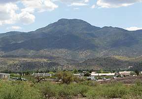 View looking up the escarpment, (from western Verde Valley) | |
| Highest point | |
| Peak | Woodchute Mountain |
| Elevation | 7,844 ft (2,391 m) |
| Coordinates | 34°44′59″N 112°10′31″W / 34.74972°N 112.17528°W |
| Dimensions | |
| Length | 45 mi (72 km) NW-SE |
| Width | 15 mi (24 km) |
| Geography | |
 Black Hills in Arizona | |
| Country | United States |
| State | Arizona |
| Region |
Arizona transition zone (north-central to Sonoran Desert) |
| District | Yavapai County, Arizona |
| Settlements | |
| Range coordinates | 34°44′59″N 112°10′31″W / 34.74972°N 112.17528°WCoordinates: 34°44′59″N 112°10′31″W / 34.74972°N 112.17528°W |
| Borders on |
Verde River & Valley - NE Lonesome Valley - NW Mazatzal Mountains - SE Bradshaw Mountains - SW |
| Rivers | Verde River |
The Black Hills of Yavapai County are a large mountain range of central Arizona in southeast Yavapai County. It is bordered by the Verde Valley to the east. The northwest section of the range is bisected from the southeast section by Interstate 17, which is the main route connecting Phoenix to Sedona, Oak Creek Canyon, and Flagstaff. This bisection point is the approximate center of the mostly northwest by southeast trending range. The northwest section contains a steep escarpment on the northeast with the Verde Valley, the escarpment being the location of the fault-block that created the historic mining district at Jerome.
The range is also the first major fault-blocked range west of the Mogollon Rim on the southwest margin of the Colorado Plateau in Arizona. The range is at the northwest-center of the Arizona transition zone which extends diagonally across central Arizona.
Description
The highest point of the Black Hills (Arizona) is Woodchute Mountain at 7,844 feet (2,391 m).[1][2] Mingus Mountain lies 4.0 miles (6.4 km) south of Woodchute Mountain with historic Cherry 8.7 miles (14.0 km) further to the southeast.
Three wilderness areas are located in the range, the Woodchute Wilderness in the northwest, and the Cedar Bench and Pine Mountain Wildernesses in the southeast.
References
- ↑ U.S. Geological Survey Geographic Names Information System: Black Hills (Yavapai County)
- ↑ Hickey Mountain, Arizona and Munds Draw, Arizona, 7.5 Minute Topographic Quadrangles, USGS, 1971 and 1973
External links
| Wikimedia Commons has media related to Black Hills. |
- Summit Post web site