Cottonwood, Arizona
| Cottonwood, Arizona | |
|---|---|
| City | |
.jpg) Commercial Historic District | |
| Motto(s): "Heart of the Verde Valley" | |
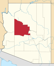
 Location of Cottonwood in Yavapai County, Arizona | |
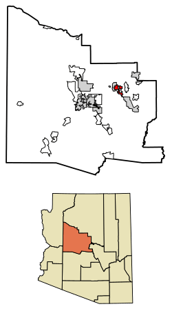
 Cottonwood, Arizona Location in Arizona  Cottonwood, Arizona Cottonwood, Arizona (the US) | |
| Coordinates: 34°43′56″N 112°1′7″W / 34.73222°N 112.01861°WCoordinates: 34°43′56″N 112°1′7″W / 34.73222°N 112.01861°W | |
| Country |
|
| State |
|
| County |
|
| Named for | Cottonwood Tree |
| Government | |
| • Mayor | Tim Elinski |
| Area[1] | |
| • Total | 16.60 sq mi (42.99 km2) |
| • Land | 16.60 sq mi (42.99 km2) |
| • Water | 0.00 sq mi (0.00 km2) |
| Elevation | 3,314 ft (1,010 m) |
| Population (2010)[2] | |
| • Total | 11,265 |
| • Estimate (2016)[3] | 11,990 |
| • Density | 722.29/sq mi (278.88/km2) |
| Time zone | UTC-7 (MST) |
| • Summer (DST) | UTC−7 (no DST/PDT) |
| ZIP code | 86326 |
| Area code(s) | 928 |
| FIPS code | 04-16410 |
| GNIS ID(s) | 27993 |
| Website | City of Cottonwood |
Cottonwood is a city in Yavapai County, Arizona, United States. According to the 2010 census, the population of the city is 11,265.[2]
Geography
Cottonwood is located at 34°43′56″N 112°1′7″W / 34.73222°N 112.01861°W (34.732145, -112.018565).[4]
According to the United States Census Bureau, the city has a total area of 10.7 square miles (28 km2), all land.
Climate
Cottonwood has a semi-arid steppe climate. In January the normal high temperature is 55 °F (13 °C) with a low of 26 °F (−3 °C). In July the normal high temperature is 97 °F (36 °C) with a low of 68 °F (20 °C). Annual precipitation is around 13 inches (33 cm).
Demographics
| Historical population | |||
|---|---|---|---|
| Census | Pop. | %± | |
| 1950 | 1,626 | — | |
| 1960 | 1,879 | 15.6% | |
| 1970 | 2,610 | 38.9% | |
| 1980 | 4,550 | 74.3% | |
| 1990 | 5,918 | 30.1% | |
| 2000 | 9,179 | 55.1% | |
| 2010 | 11,265 | 22.7% | |
| Est. 2016 | 11,990 | [3] | 6.4% |
| U.S. Decennial Census[5] | |||
As of the census[6] of 2000, there were 9,179 people, 3,983 households and 2,369 families residing in the city. The population density was 860.3 people per square mile (332.1/km²). There were 4,427 housing units at an average density of 414.9 per square mile (160.2/km²). The racial makeup of the city was 85.24% White, 0.49% Black or African American, 1.57% Native American, 0.41% Asian, 0.03% Pacific Islander, 9.66% from other races, and 2.59% from two or more races. 20.53% of the population were Hispanic or Latino of any race.
There were 3,983 households out of which 25.3% had children under the age of 18 living with them, 44.5% were Married Couples living together, 10.8% had a female as Head of Household with no Husband present, and 40.5% were non-families. 34.4% of all households were made up of individuals and 19.1% had someone living alone who was 65 years of age or older. The average household size was 2.27 and the average family size was 2.90.
In the city, the population was spread out with 23.4% under the age of 18, 8.2% from 18 to 24, 23.3% from 25 to 44, 21.4% from 45 to 64, and 23.8% who were 65 years of age or older. The median age was 41 years. For every 100 females, there were 86.9 males. For every 100 females age 18 and over, there were 81.4 males.
The median income for a household in the city was $27,444, and the median income for a family was $37,794. Males had a median income of $24,308 versus $19,977 for females. The per capita income for the city was $17,518. About 8.9% of families and 13.5% of the population were below the poverty line, including 19.5% of those under age 18 and 11.3% of those age 65 or over.
The city became one of the Arizona municipalities to approve of civil unions for same-sex partners.[7][8]
Education
Cottonwood-Oak Creek School District operates public schools.
Library
The Cottonwood Public Library is part of the Yavapai County Library Network and serves the city of Cottonwood along with surrounding cities including Clarkdale, Camp Verde, and Rimrock.[9]
Notable people
- Junior Brown - country singer and guitarist
- Alvie Self - singer, member Rockabilly Hall of Fame
See also
References
- ↑ "2016 U.S. Gazetteer Files". United States Census Bureau. Retrieved Jul 18, 2017.
- 1 2 "American FactFinder". United States Census Bureau. Retrieved 2014-08-05.
- 1 2 "Population and Housing Unit Estimates". Retrieved June 9, 2017.
- ↑ "US Gazetteer files: 2010, 2000, and 1990". United States Census Bureau. 2011-02-12. Retrieved 2011-04-23.
- ↑ "Census of Population and Housing". Census.gov. Retrieved June 4, 2016.
- ↑ "American FactFinder". United States Census Bureau. Archived from the original on 2013-09-11. Retrieved 2008-01-31.
- ↑ "Cottonwood Council approves civil union registry". Verde Independent. Retrieved 2018-07-27.
- ↑ Press, Associated (2013-12-19). "Cottonwood latest to approve civil unions". KNXV. Retrieved 2018-07-27.
- ↑ "Cottonwood Public Library". Cottonwood Public Library. Retrieved 2013-02-12.
External links
| Wikimedia Commons has media related to Cottonwood, Arizona. |
- City of Cottonwood
- Verde Independent - Local newspaper