Pegunungan Bintang Regency
| Pegunungan Bintang Regency Kabupaten Pegunungan Bintang | ||
|---|---|---|
| Regency | ||
| ||
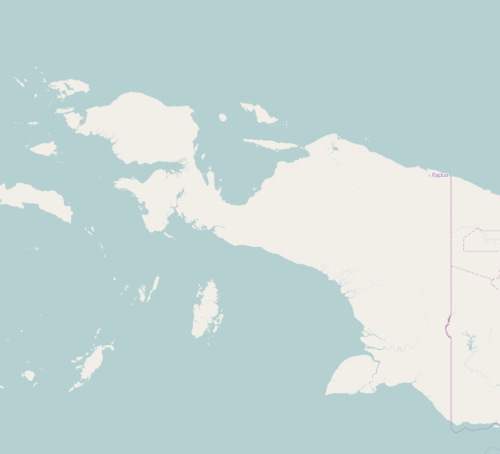 Pegunungan Bintang Regency Location in Western New Guinea and Indonesia  Pegunungan Bintang Regency Pegunungan Bintang Regency (Indonesia) | ||
| Coordinates: 4°31′18″S 140°17′43″E / 4.5217°S 140.2954°ECoordinates: 4°31′18″S 140°17′43″E / 4.5217°S 140.2954°E | ||
| Country |
| |
| Province | Papua | |
| Capital | Oksibil | |
| Government | ||
| • Regent | Costan Oktemka | |
| • Vice Regent | Decky Deal | |
| Area | ||
| • Total | 15,682 km2 (6,055 sq mi) | |
| Population (2014) | ||
| • Total | 80,516 | |
| • Density | 5.1/km2 (13/sq mi) | |
| Time zone | UTC+9 (Indonesia Eastern Time) | |
| Area code | (+62) 975 | |
| Website | pegbintangkab.go.id | |

Pegunungan Bintang Regency, or Bintang Mountains Regency is one of the regencies (kabupaten) in Papua Province of Indonesia. It covers an area of 15,682 km2, and had a population of 65,434 at the 2010 Census;[1] the latest official estimate (as at January 2014) is 80,516. The administrative centre is Oksibil.
Administrative Districts
The Bintang Mountains Regency comprises 34 districts (kecamatan), tabulated below with their populations at the 2010 Census:[2]
|
|
|
|
The number of districts increased dramatically prior to 2010, created by the division of the six original districts; Kawor, Tarup and Awinbon were created from parts of Iwur District; Pepera, Alemsom, Serambakon, Kolomdol, Oksop, Sebang, Ok Bape and Ok Aon were created from parts of Oksibil District; Bime, Epumek, Weime, Pamek, Nongme and Batani were created from parts of Borme District; Aboy, Okbab, Teiraplu and Yefta were created from parts of Okbi District; East Kiwirok, Okhika, Oklip and Warasamo were created from parts of Kiwirok District; and Murkim, Mofinop and Okbemta were created from parts of Batom District.