Bertaut Reef
 Bertaut Island Location of Bertaut Island in Seychelles | |
| Geography | |
|---|---|
| Location | Indian Ocean |
| Coordinates | 05°39′S 53°14′E / 5.650°S 53.233°ECoordinates: 05°39′S 53°14′E / 5.650°S 53.233°E |
| Archipelago | Seychelles |
| Adjacent bodies of water | Indian Ocean |
| Total islands | 1 |
| Major islands |
|
| Area | 0.003 km2 (0.0012 sq mi) |
| Length | 0.07 km (0.043 mi) |
| Width | 0.04 km (0.025 mi) |
| Coastline | 0.2 km (0.12 mi) |
| Highest elevation | 0 m (0 ft) |
| Administration | |
| Group | Outer Islands |
| Sub-Group | Amirante Islands |
| Districts | Outer Islands District |
| Demographics | |
| Population | 0 (2014) |
| Pop. density | 0 /km2 (0 /sq mi) |
| Ethnic groups | Creole, French, East Africans, Indians. |
| Additional information | |
| Time zone | |
| ISO code | SC-26 |
| Official website |
www |
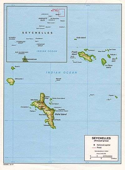
Bertaut Island is an island in Seychelles, lying in the Outer Islands of Seychelles, with a distance of 271 kilometres (168 miles) south of Victoria, Seychelles.
Geography
Bertaut Reef is about 25 kilometres (16 miles) SSW of St. Joseph Atoll and 13.5 kilometres (8.4 miles) north of Poivre Atoll. Desroches Island is 50 kilometres (31 miles) to the east. The reef measures 8.4 kilometres (5.2 miles) northwest-southeast, and is up to 3.4 kilometres (2.1 miles) wide in the southeastern part, and up to 2.7 kilometres (1.7 miles) in the northwestern part. It covers an area in excess of 20 km2. Only in the south and southeast waves break over a shallow reef edge. Bertaut Reef has a small uninhabited and unvegetated sand cay on its southern part, with an area of about 3000 m2. The reef is steep-to and the sea breaks heavily over its edge.
Administration
The island belongs to Outer Islands District.[1]
Image gallery
 Map 1
Map 1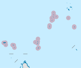 District Map
 NASA image
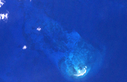 Sat image
References
External links
Outer islands of Seychelles / Coralline Seychelles (Zil Elwannyen Sesel) | |||||||||||
|---|---|---|---|---|---|---|---|---|---|---|---|
| Outer island Groups |  | ||||||||||
| Islands and Atolls |
| ||||||||||