Providence Atoll
 Providence Atoll | |
| Geography | |
|---|---|
| Location | Indian Ocean |
| Coordinates | 09°18′S 51°00′E / 9.300°S 51.000°ECoordinates: 09°18′S 51°00′E / 9.300°S 51.000°E |
| Archipelago | Seychelles |
| Adjacent bodies of water | Indian Ocean |
| Total islands | 2 |
| Major islands |
|
| Area | 2.82 km2 (1.09 sq mi) |
| Highest elevation | 0 m (0 ft) |
| Administration | |
| Group | Outer Islands |
| Sub-Group | Farquhar Group |
| Sub-Group | Providence Islands |
| Districts | Outer Islands District |
| Largest settlement | Providence (pop. 0) |
| Demographics | |
| Population | 0 (2014) |
| Pop. density | 0 /km2 (0 /sq mi) |
| Ethnic groups | Creole, French, East Africans, Indians. |
| Additional information | |
| Time zone | |
| ISO code | SC-26 |
| Official website |
www |
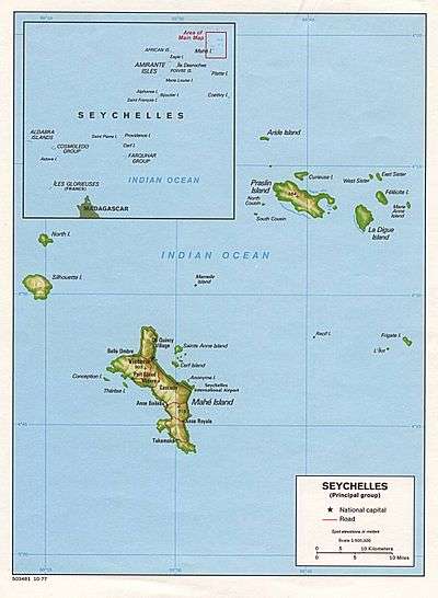
The Providence Atoll is part of the Farquhar Group of islands in the Seychelles that are part of the Outer Islands, with a distance of 705 km (438 mi) southwest of the capital, Victoria, on Mahé Island.
History
The atoll was discovered in 1501 by Joao da Nova, a Portuguese explorer. The atoll was under British control until 1976 when they became part of Seychelles at the time of independence.[1] Providence got its name after an event which happened in 1763. A French frigate, ”Heureuse” , was stranded on its reef, 705 km from Victoria near the northern end of the atoll. The sailors reached Providence Island and were rescued a month later. It proved the salvation(fr: Providence) of the French sailors. Cerf got its name after one of the ships of Captain Nicolas Morphey, called Le Cerf, who sighted the island on 30 July 1756.
Geography
The islands of Providence Atoll are small, coraline and inhospitable. The atoll has length of 44 km (27 mi) on its north-south axis, and about 12 km (7 mi) width. The total area covered by the atoll is approximating 345 km2 (133 sq mi). The aggregate land area, however, is only 2.82 km2 (1.1 sq mi). West of the atoll, the sea-bottom plunges steeply to 180 metres only, 2.5 km beyond the fringing reef.[2]
Providence Atoll Islands
There are two islands in the atoll:
Providence Island
Providence Island is located in the far north of the atoll, at 9°13′S 51°02′E / 9.217°S 51.033°E. It is 3.6 km (2 mi) long north-south, and up to 650 m (2,130 ft) at its widest part. It has the shape of a kite. The land area is 1.72 km², with a coastline of 7.8 km (5 mi).
Cerf Island
Cerf Island is located in the far south of the atoll, 30 km (19 mi) south of Providence Island, at 09°31′59″S 50°59′10″E / 9.53306°S 50.98611°E. The island is 4.6 km (3 mi) long, and up to 900 m (3,000 ft) at its widest part, but in some places only 10 m (33 ft) wide, which causes at high tide an appearance of a northern island and a southern island. Cerf's land area is 1.1 km2 (0.4 sq mi), with a coastline of 17 km (11 mi). The closest neighbor of the atoll is St. Pierre Island, 35 km (22 mi) west of Cerf Island.
Demographics
Providence Island had a small settlement in the middle of the island, at 9°13′50″S 51°01′54″E / 9.23056°S 51.03167°E with 6 villagers,[3] But in 2006, Cyclone Bondo destroyed most of the buildings and about 60 per cent of the coconut trees,[4][5] The government plans on building an eco-tourism resort on the island in 2018, and a bidding process is already on the way.[6][7] Cerf Island has never been permanently inhabited though temporary fishermens' huts were recorded in the 19th century. There are many shipwrecks including records of Maldivian mariner presence in this atoll from the 20th century, when a trading vessel from southern Maldives reached Providence Atoll after drifting in the ocean for weeks.[8]
Administration
The atoll belongs to Outer Islands District.[9]
Transport
Providence Island has no jetty, no airstrip and no transport links. The island is rarely visited except by the occasional Island Conservation Society expedition or by an Islands Development Company (IDC) boat from Mahé.
Economics
Providence Island was inhabited by workers engaged in fishing and copra production probably continuously from at least 1846 until late 2006. Following Cyclone Bondo,the island was evacuated on 26 December 2006. A subsequent attempt to construct an airstrip to service the inhabitants was abandoned and the island has remained uninhabited since then.
Flora and fauna
Providence Atoll occupies an extensive bank of shallow water well known for its profusion of fish.
There are no alien mammals and the only land bird is Madagascar Fody.
Significant numbers of Greater Crested Tern and Black-naped Tern breed at Cerf Island. There are also very large numbers of Grey Heron breeding in the largest heronry of Seychelles and small numbers of Fairy Tern.
Tourism
The island is a famous fly-fish destination[10]
Image gallery
 Map 1
Map 1 Providence Atoll
Note: This image is not aligned North/South, Providence Island runs very close to N/S, unlike this image
References
- ↑ History
- ↑ Info on the island 2 Archived 2016-04-13 at the Wayback Machine.
- ↑ The Islands of the Seychelles Archived 2009-02-04 at the Wayback Machine.
- ↑ Cyclone info
- ↑ News on Cyclone
- ↑
- ↑ IDC site
- ↑ Xavier Romero-Frias, The Maldive Islanders, A Study of the Popular Culture of an Ancient Ocean Kingdom. Barcelona 1999, ISBN 84-7254-801-5
- ↑ District map
- ↑ Info and gallery
External links
- National Bureau of Statistics
- National Bureau of Statistics - Partial info on islands

Outer islands of Seychelles / Coralline Seychelles (Zil Elwannyen Sesel) | |||||||||||
|---|---|---|---|---|---|---|---|---|---|---|---|
| Outer island Groups |  | ||||||||||
| Islands and Atolls |
| ||||||||||