Berbeo
| Berbeo San Fernando de Aguablanca, Lengupá | |||
|---|---|---|---|
| Municipality and town | |||
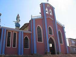 Church of Berbeo | |||
| |||
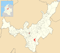 Location of the municipality and town of Berbeo in the Boyacá Department of Colombia | |||
| Coordinates: 5°13′36″N 73°07′36″W / 5.22667°N 73.12667°WCoordinates: 5°13′36″N 73°07′36″W / 5.22667°N 73.12667°W | |||
| Country |
| ||
| Department | Boyacá Department | ||
| Province | Lengupá Province | ||
| Founded | 23 April 1743 | ||
| Founded by | Jesuits | ||
| Government | |||
| • Mayor |
Julio Roberto Parra (2016-2019) | ||
| Area | |||
| • Municipality and town | 61.72 km2 (23.83 sq mi) | ||
| • Urban | 0.13 km2 (0.05 sq mi) | ||
| Elevation | 1,350 m (4,430 ft) | ||
| Population (2015) | |||
| • Municipality and town | 1,932 | ||
| • Density | 31/km2 (81/sq mi) | ||
| • Urban | 529 | ||
| Time zone | UTC-5 (Colombia Standard Time) | ||
| Website | Official website | ||
.svg.png)
.svg.png)
Berbeo is a town and municipality in the Lengupá Province, part of the Colombian department of Boyacá. The urban centre of Berbeo is located at an altitude of 1,350 metres (4,430 ft) in the Eastern Ranges of the Colombian Andes. Berbeo borders San Eduardo in the east, Zetaquirá and Miraflores in the west, Zetaquirá in the north and Miraflores and Páez in the south.[1]
Etymology
The municipality was formerly called San Fernando de Aguablanca and Legupá, and since 1913 bears the name Berbeo, after Juan Francisco Berbeo.[1]
History
The area of Berbeo before the Spanish conquest was inhabited by the indigenous Muisca. In Berbeo petroglyphs have been discovered. Modern Berbeo was founded on April 23, 1743 by Jesuits.[1]
Economy
Main activity of Berbeo is agriculture, with coffee and chonto tomatoes as major products.[1]
Gallery
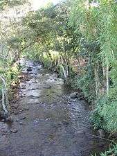 Agua Blanca creek
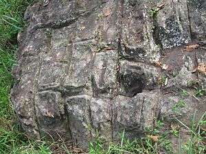 Petroglyphs
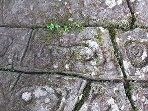 Petroglyphs
References
| Wikimedia Commons has media related to Berbeo. |
- 1 2 3 4 (in Spanish) Official website Berbeo